River Suir

Blue Way of County Tipperary II

We continue from Dove Hill Norman Tower, and I hope we make it to Poulakerry Tower House. The season is spring.

We see a glimpse of several ruins as we walk. River Suir was the main access route, and has been used by the early Christians, the Vikings, the Normans and everyone else over the centuries. The four-storey Dove Hill tower house has been changing keepers since it was erected in the 14th century. The Earl of Ormond is listed as the proprietor in 1640 when the tower was described as “a small castle wanting repaire“.

This is a closer look. The ivy-clad ruin stands right across the road from the Dove Hill Irish Design Centre.

Suir Blueway was officially launched in May 2019 and the path was paved in 2018. Before that the path looked like in the pictures below, and I loved it much more than its paved version. In fact, it makes me sad when I see all that paving, drainage or tree cutting in the wildlife habitats intended to accommodate our selfish wants. There are very little habitats left in Ireland, and very little wildlife.

Now and then we see an angler. River Suir is still rich in salmon and has the distinction of producing Ireland’s record rod-caught salmon that weighed 57 lb ( 25.9 kg) and was taken on a fly by Michael Maher in 1874. .

We walk some 2-3 kilometers and there is no other sound than the buzzing of bees and chirping of birds.

Then suddenly we hear a ‘white noise’ that grows louder as we walk – it is the sound of the rapids.

Nothing dramatic here, just the shallow water and the rocks, but the sound is impressive.

I take a slow shutter picture of the water.

River Suir is not deep along the Blueway. All the navigation takes place to the south of Carrick-on-Suir.

We walk another kilometre in solitude. There is MSD biotechnology company site somewhere at this stretch of the riverwalk, but they make themselves invisible, and they are a good employer anyway…

We pass so-called Glyn Castle – the house with a rich history built on the site of an ancient castle.

Waterford- Clonmel railway comes close to the river at this point.

More walking.

There are birds – robins, wrens, green finches.

Heron makes a comical takeoff.

The beautiful vistas of the green Irish countryside provide a lovely ending to our 6 km long walk.

Some more birds as we approach the outskirts of my favorite village.

We made it to the Poulakerry tower house!

In my next blog we are going to stay in the village of Kilsheelan and walk between the Poulakerry tower house and Gurteen Castle.

  Have a happy week!

Cheekpoint

I have written about River Suir before. Two latest Little Island posts gave me idea of following the river a little further. On the map below you see the Little Island pointing to the green chunk of land with the river coiled around it. It is the point where the rivers Barrow and Nore meet their sister Suir and together start their final journey to the sea.

I don’t even have to write much – Cheekpoint has a resident blogger and author Andrew Doherty 

You see a couple of pins on the map. They mark the places where my pictures were taken from. I will add some commentary, but most of the information I am going to share with you has come from Andrew’s blog Waterford Harbour Tides and Tales.

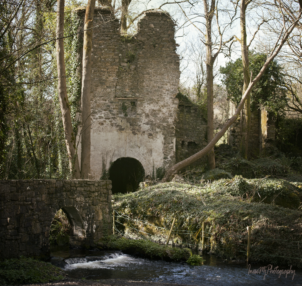
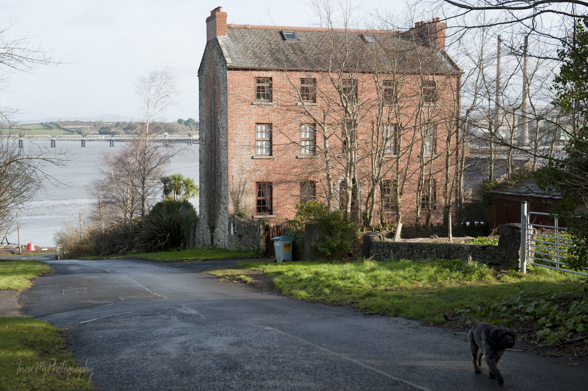
To get to Cheekpoint, we make a right turn from the Passage East Road, Waterford, and keep to the left under the bridge. The first thing you notice is a ruin surrounded by trees and ivy that is not marked on my map. The ruin is not a tower or castle but a mill that ceased to operate in the 1930-s.  Delahunty’s Mill is a silent relic of the industrial past of the land.


After Strongbow arrived in Waterford harbour in 1170, Henry II landed in Passage East the following year and granted strategically important lands surrounding the harbour to Juvenis Aylward, a merchant from Bristol who provided financial support to the expedition. The lands remained in the Aylward family for 450 years and went to the Cromwellian ‘officer of Dragoons’ Captain William Bolton in 1667. His descendants had been farmers, politicians and businessmen who built Faithlegg House, established Cheekpoint village, port, cotton manufactory and hofiery ( read about the Stocking Frame here), lime kilns and mills. They planted a forest, drained and walled salt marshes, improved the roads; Cheekpoint Packet Station run by Captain Thomas Owen commenced in 1787 and flourished until the end of Napoleonic Wars.


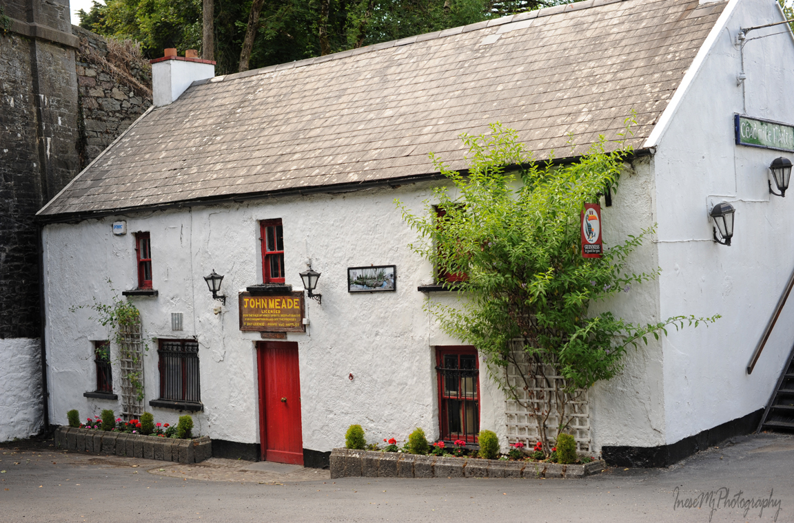
When we emerge from under the bridge, there is an old building on our left, Jack Meade’s bar. Their beer garden looks very attractive, and they also have two 19th century lime kilns and an ice house in the grounds. The bar dates back to 1705 and belongs to the present family since 1857.

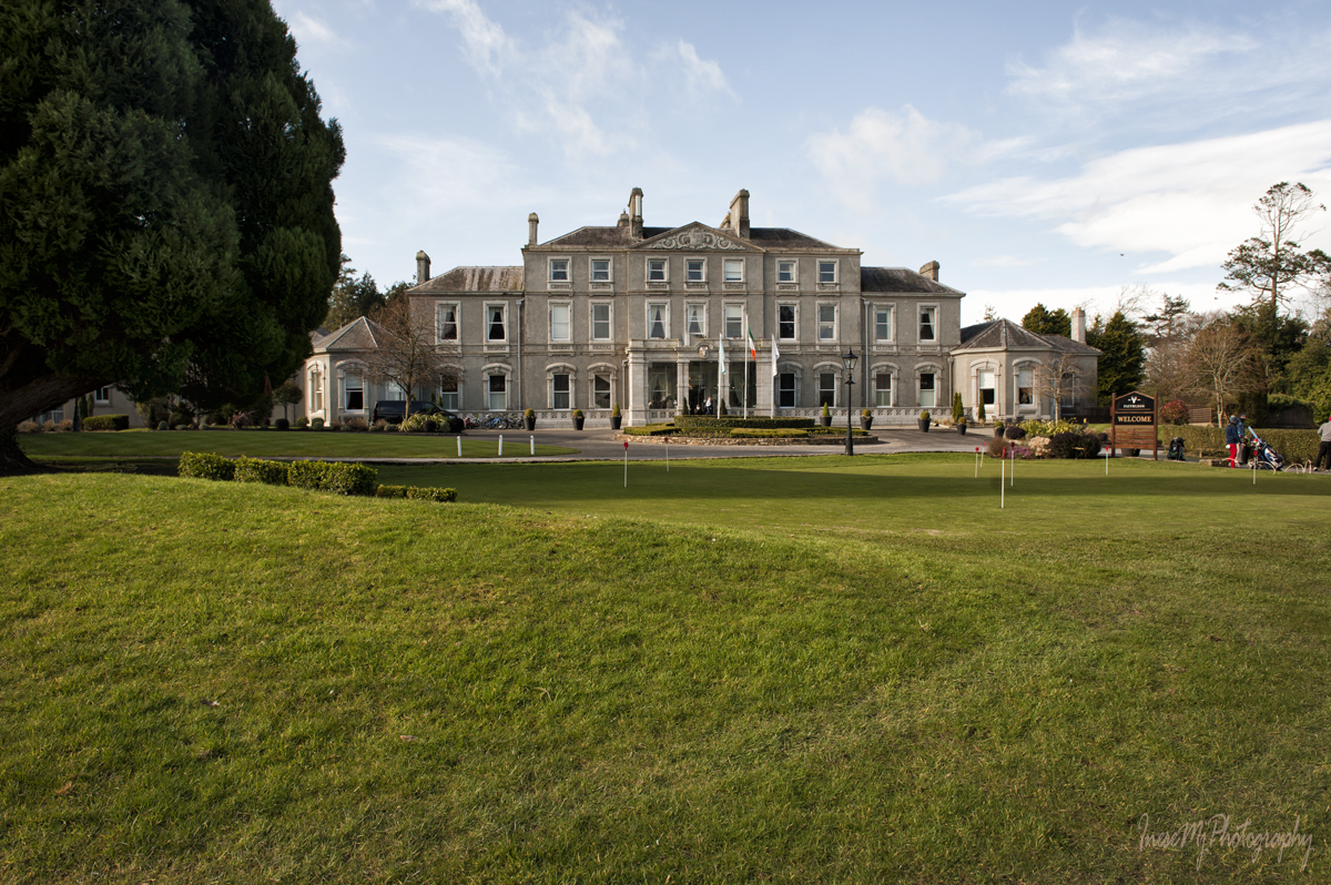
We follow the Cheekpoint road and turn left after a couple of miles to Faithlegg Golf Club .

Cornelius Bolton inherited the Faithlegg estate in 1779. Being a prominent Waterford businessman and politician he built a stately house ( the architect is believed to be John Roberts). Unfortunately, with the end of Napoleonic Wars most of his investments failed and he had to sell the house to Nicholas Power and retire to his Waterford residence. Nicholas adorned the House with his family crest – the Stag head. In 1935 the House was sold and became a De La Salle college; in 1998 – a golf club and hotel.

We return to the main road and stop at the Faithlegg Church and graveyard. There is a ruin of a nave and chancel of the church that was possibly built in the 13th-14th century, however there are written records of this church in the 12th century. The difference in masonry of the front and back part of the ruin indicates that there are indeed two churches – one built in Romanesque style, and the other in a later Venetian Gothic style. The ruin is preserved by the efforts and financial help of community.

There is also a newer church that dates from 1826 and is still in use. This is a 1928 image of it from https://tidesandtales.ie/old-faithlegg-churc/. The spire was erected by Nicholas Power. The church looks pretty much the same except for the shrubbery and ivy which are gone now.

In the church graveyard there is a number of remarkable graves, like the grave of William Doyle who sailed the globe with Captain Cook. There is also Thomas Francis Meagher family vault.

We continue along the Cheekpoint road and turn left, up the Minaun Hill. A short walk from the car park takes us to the top. The views are spectacular. Dunbrody Abbey in the picture below is just a couple of miles away, but they say you can see seven counties from here on a clear day.

Numerous steep trails take you around the hill so that you have a 360° view. This is Port of Waterford.

This is the Faithlegg House with Little Island in background. You can see the black&white tower if you zoom closer.

A massive piece of volcanic rock  – The Cromwell’s Table – is a popular viewpoint. If you are tall enough you might see Saltee Islands from here. In the picture below you see the estuary and the village of Passage East. We will get there in the end of this blog.

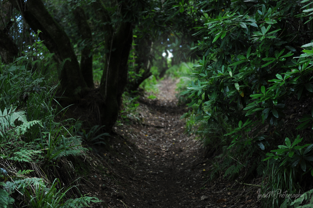
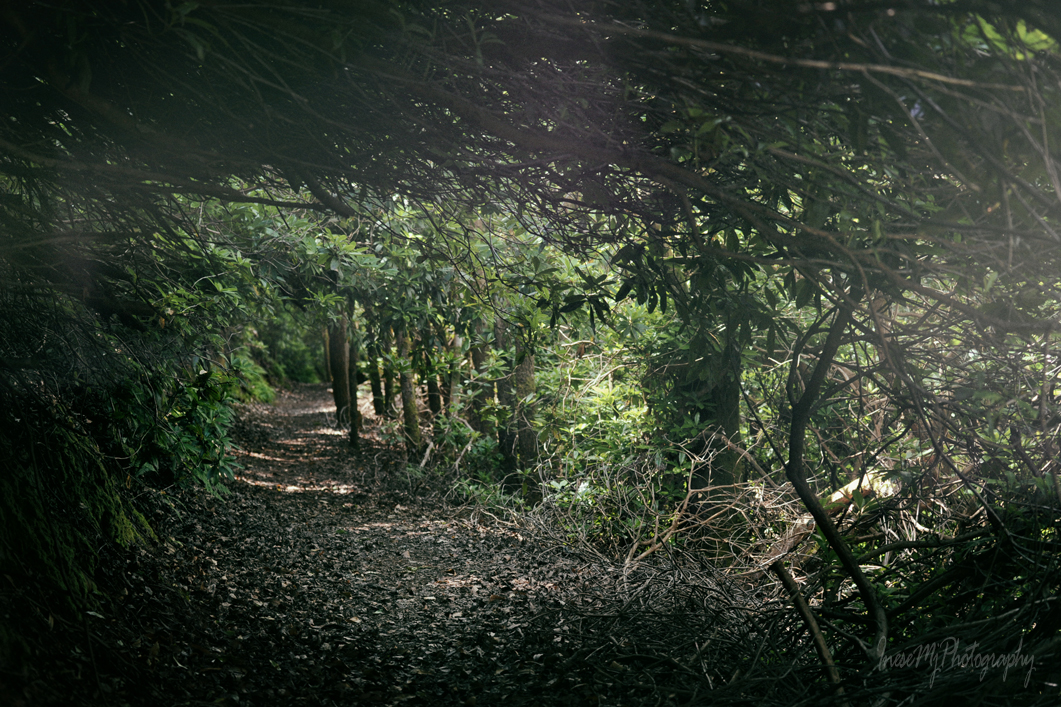
The Rhododendron Walk is another beautiful and mysterious place. It stretches on the north part of the Minaun, closer to the Waterford port on the other side of the river. I had a blood-chilling experience while walking there alone in twilight last year. I even have a horror video from that walk, but cannot figure out how to post it in WordPress. So I will keep this story for the future use.

After all the walks and sight-seeings we finally reach the Cheekpoint village. This elegant red brick building, now a family home, used to be another Cornelius Bolton’s enterprise – a Coaching Inn. Daisybank House has a long history of which you can read about in Andrew’s blog.

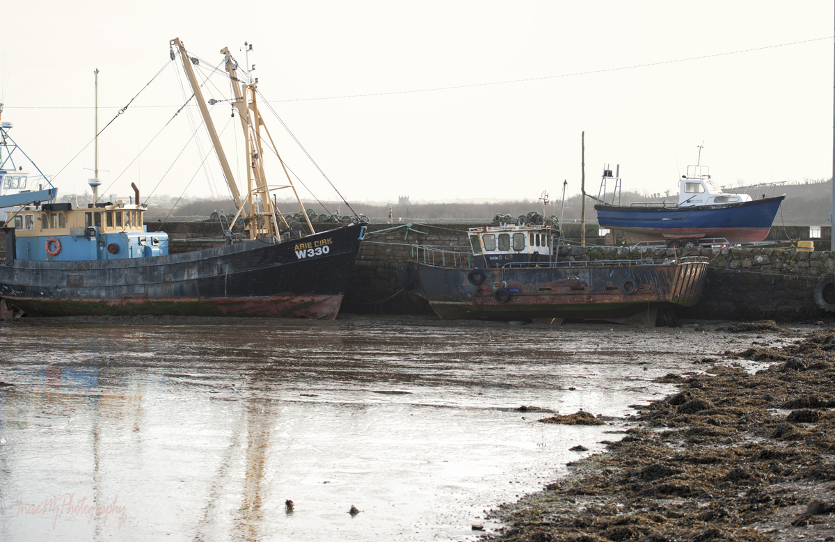
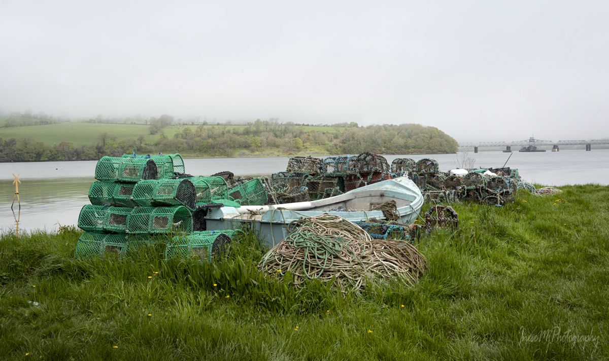
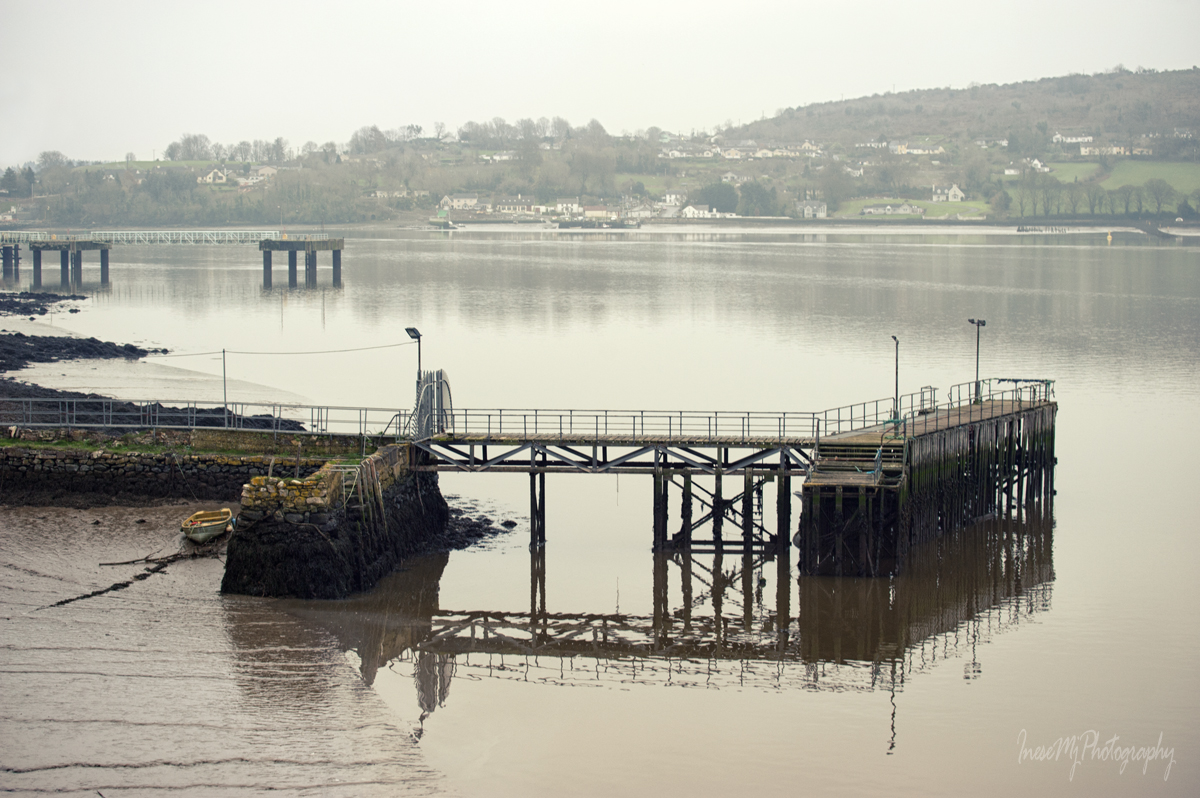
Here are some pictures of Cheekpoint port and strand taken in different years.

The following eight pictures are taken from the strand.

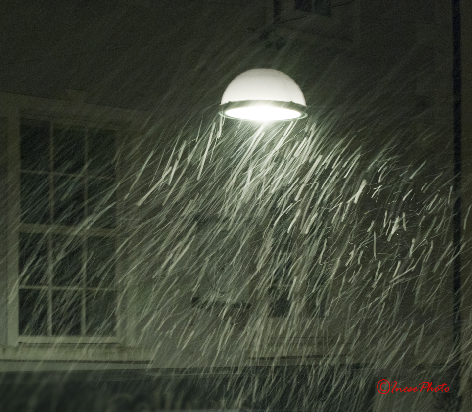
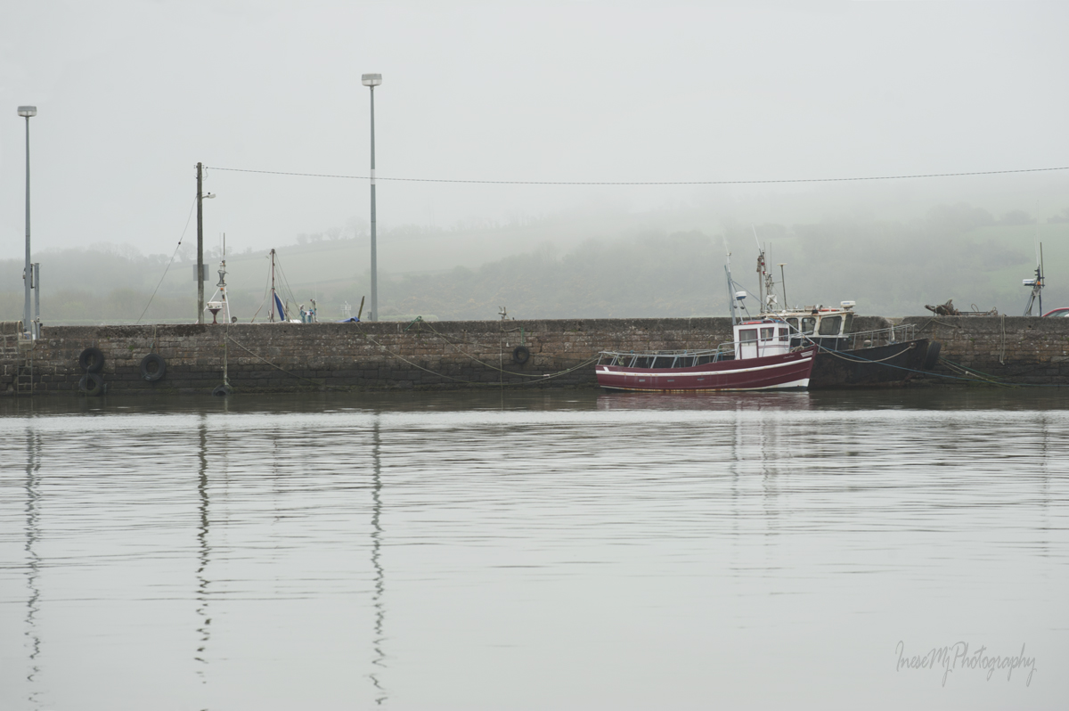
Fog is a frequent occurrence in Cheekpoint.

Cheekpoint fishing weirs have a long history. Here you can learn the difference between Head weirs and Scotch weirs, and read about the Weir Wars.

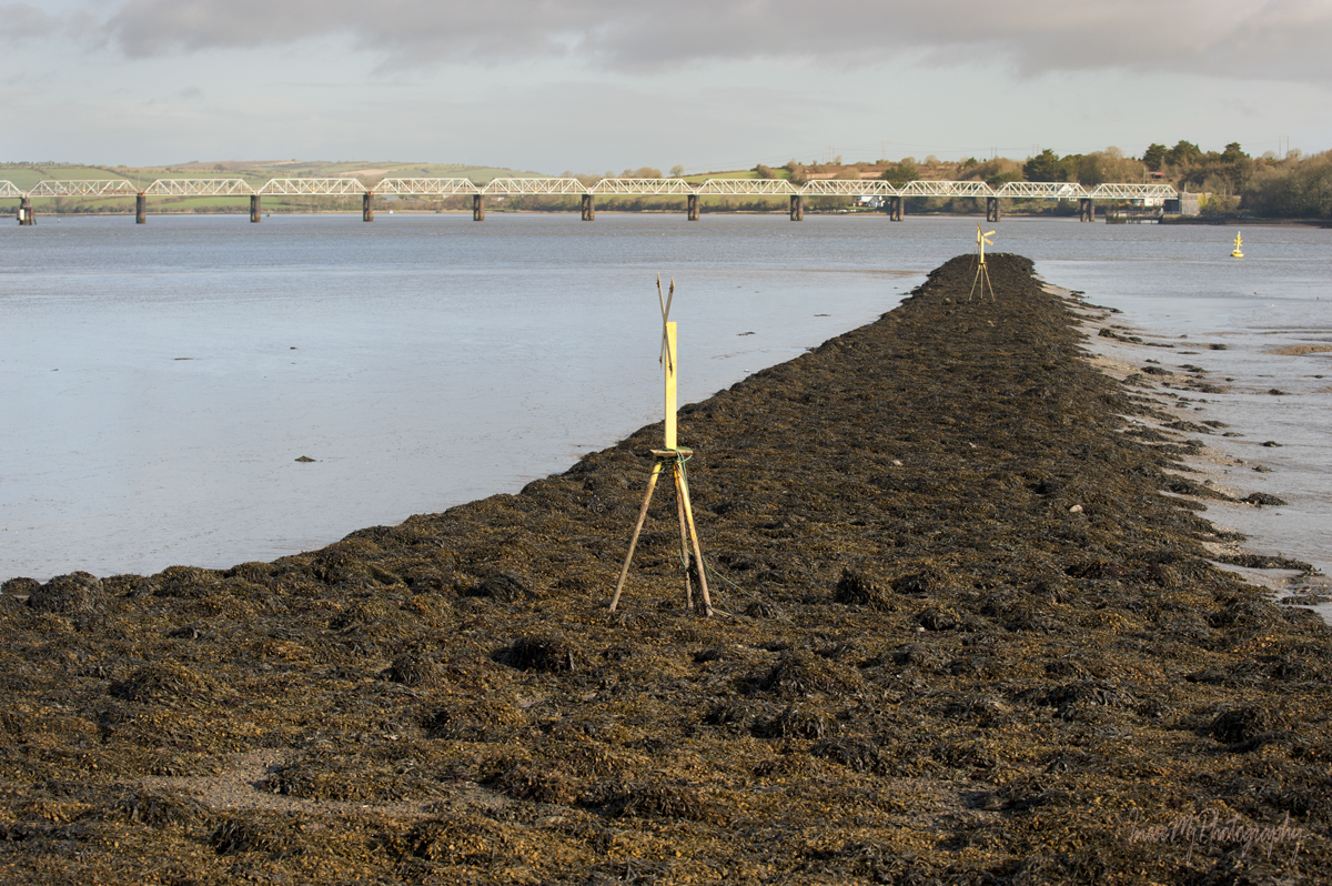
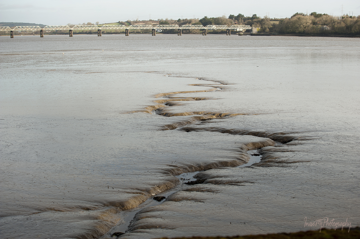
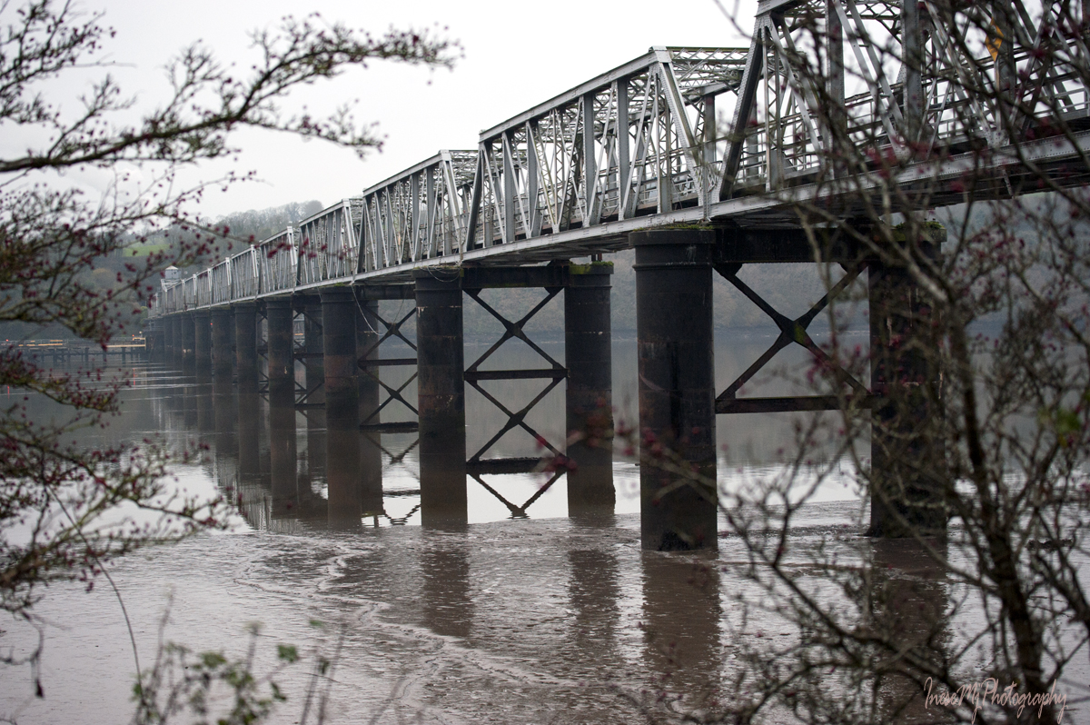
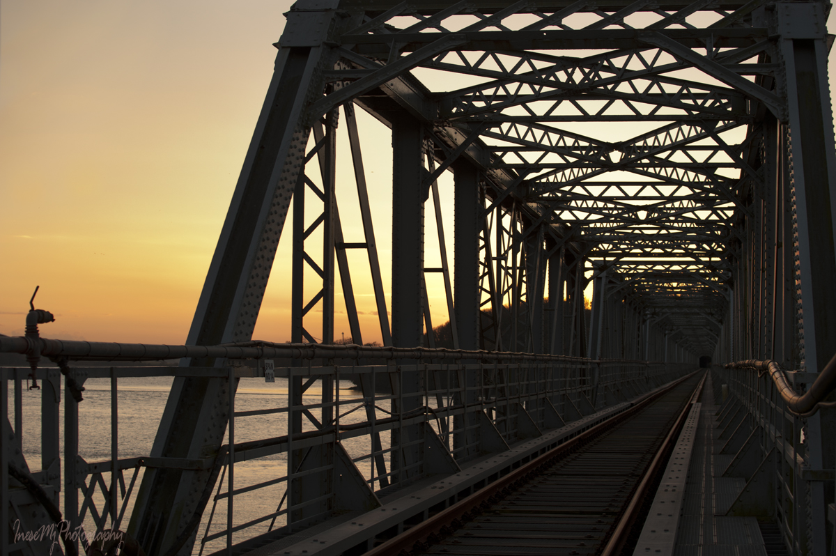
Barrow railway bridge was opened in 1906 and closed in 2010. Nearly mile long, it has 13 spans one of which opens to let the yachts pass under the bridge. Sad that this beauty has no practical use anymore, but being an important landmark it is very appreciated among photographers.

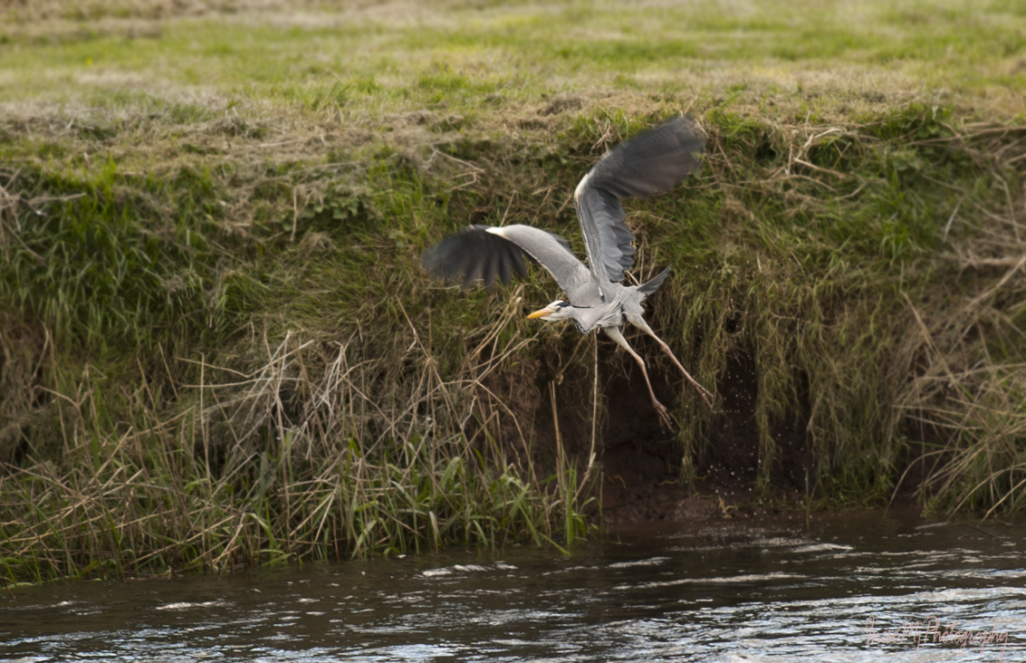
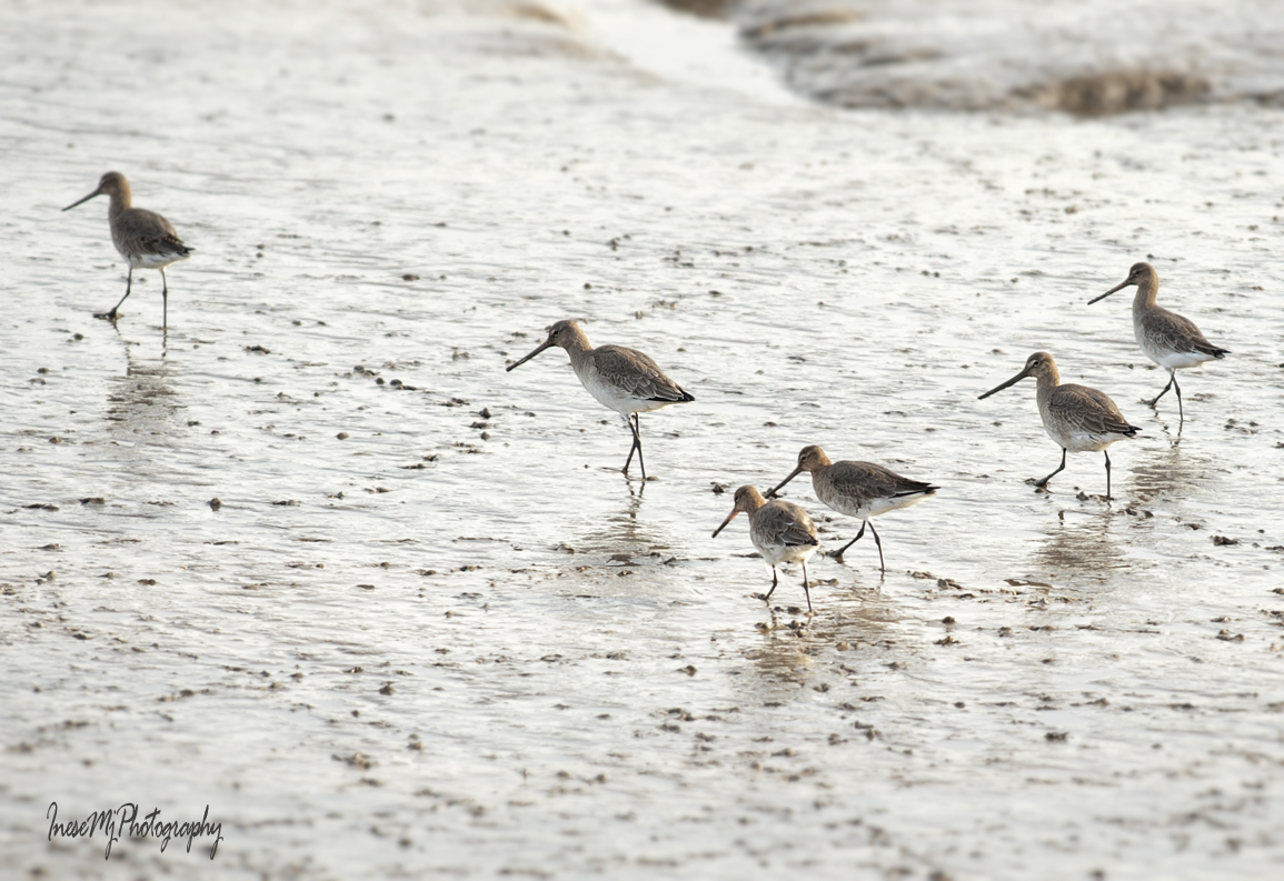
A flock of Godwits are picking lugworms at low tide.

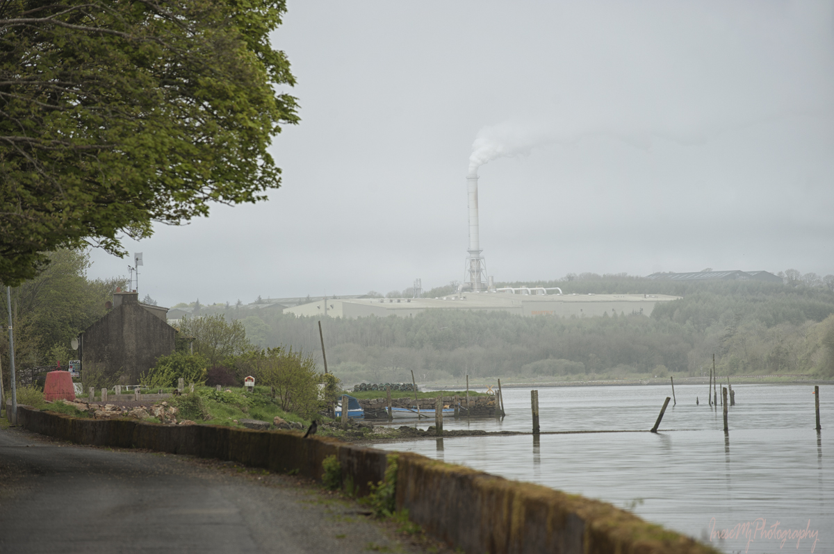
With SMARTPLY manufacturing site in background, we walk to the end of the strand towards the Rookery.

All the buildings in the Rookery are unique. The time has stopped there long ago.

This house was built by Cornelius Bolton junior in 1786-1800. The house comes with the quay, dock and walled garden. I have read that the fishing weirs used by the owner’s family were built by Cistercian monks in 1177.

The house was for sale at the time of my visit, so I went to the quay and took this picture.

This is the dock and remains of the ancient fishing weirs. I fell in love with the place. I think it has been sold by now 🙂

Here are some closer pictures of the Barrow Bridge.

This is what Cheekpoint and Minaun Hill look like from the opposite bank.

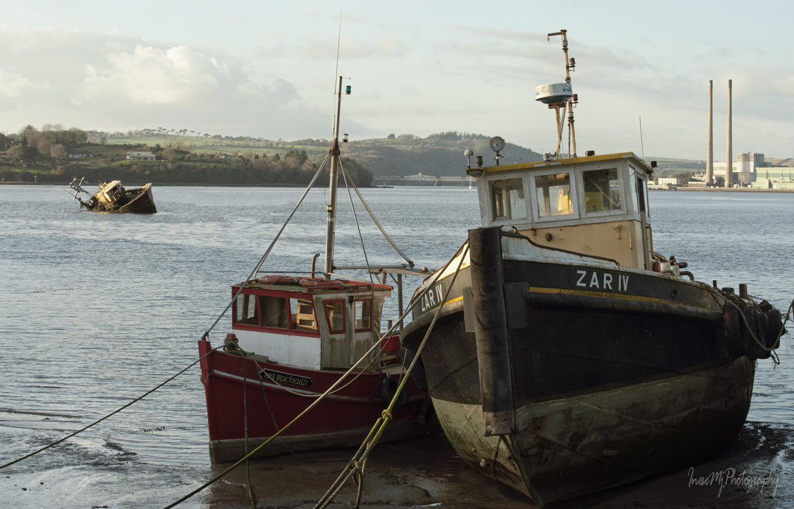
In the picture below you see the Russian Side – the east part of Cheekpoint. The twin stacks on the right belong to the Great Island power station sitting across the river like a sore thumb. In my previous pictures I made sure to keep it out of frame. The picture was taken from the Wexford side of the river. I don’t know the story of the abandoned boat. You can see it in Google Earth.

Besides photography, there is another cool thing you can do in Cheekpoint: ship watching.

Up to twenty ocean liners used to visit Waterford annually. Only the larger ones drop anchor at Dunmore East – the other ships continue to the Port of Waterford at Belview, passing Cheekpoint on the way.

On my last visit in September I was lucky to observe Pacific Princess departing from Port of Waterford. I was on my way home when I caught a glimpse of the liner through the gap between the trees. I took a few pictures and hurried to Passage East.

For those who remember the name – it is not THAT Pacific Princess. The ship featured in the romantic comedy series The Love Boat was purchased by Turkish shipbreaking company Cemsan in 2012 and obviously ceased to exist. This Princess was built in 2002.

Princess Cruises have a history of ‘deliberated pollution’ – illegal waste discharge, but it seems that Pacific Princess has no major problems with environmental compliance.

I arrived to Passage East just in time to hear the ship horn blast as she passed the village and continued through the estuary to the Irish Sea. The passage from Belview to the sea is approximately 1.5 hours.

Thank you for joining me on this walk around Cheekpoint and Faithlegg. We will return to River Suir to walk the 20 km long Blue Way, this time in County Tipperary.

  Have a happy week!


River Suir burst its banks

I apologize for the silence.

To keep the blog looking updated, I add some more November pictures of a spectacular flood of the River Suir.

On the following day the rain ceased and the flooded area slightly shrank and was disconnected from the river. It will eventually dry up in summer.

The river remains swollen and the walking trail flooded.

Heron doesn’t mind.

Thank you for your kind support.

Have a wonderful week!

St. John’s River: Confluence

This and the following four posts are dedicated to the Friends of St. John’s River.


Waterford is situated along the beautiful River Suir – the river one cannot miss. Many visitors, however, might never realise that there is another river sneaking behind the Waterford Crystal House – St. John’s River, which, according to her Friends, represents the heart of the city. About a mile from the Rice bridge River Suir curves to the SE direction. Right before the curve is where two rivers meet.

Until the 18th century, St. John’s River didn’t have banks – there was a marshland and a pool of water that filled up at high tide and almost emptied at low tide. The pool was drained, the city expanded, and St. John’s River was contained within the banks reinforced with stone all the way to the River Suir. Here is some more history.

We know where the mouth of St. John’s River is, but where is the source? I don’t know it, but we will walk as far as we can and try to find it out.

Meanwhile, lets stay at the mouth of the river a little longer and enjoy the wildlife.

This heron at Marina hotel is wise enough to understand that photographers cannot fly over the fencing.

This gull is probably an adult non-breeding Herring gull.

These two look like young Great black-backed gulls. My knowledge of the juvenile gull classification is almost nonexistent.

One ‘teenager’ annoying the other 🙂

The cutest group of Black-headed gulls in their winter plumage. I have no idea what is that ‘stranger’ they have adopted.

The last look at the River Suir from the Scotch Quay before we are off to follow St. John’s River through the city.

We walk to the Georges Quay. The unnamed metal pedestrian bridge connects to the Adelphi Quay.

Gigantic red buoy in the Georges Quay is a lovely bright detail among the grey surroundings.

Pigeons are heading to the William Street Bridge. So are we.

We cross to the other side of St. John’s River. William Street bridge was built between 1780-1820. It is a single arch humpback bridge.

Pigeons are foraging on the walls.

We pass the car park and enter City Courthouse grounds. Courthouse was built to the design of Terence O’Reilly on the site of the ruins of St Catherine’s Abbey in 1841. Many of the dead from the 1604 outbreak of plague were buried in these grounds. Courthouse was recently refurbished and extended. In 2016, after the epic All-Ireland hurling semi-final, Kilkenny flag was put out at the top of the Courthouse .You might remember my blog post where I mentioned the long lasting rivalry between our two counties divided by River Suir.

I am mostly interested in starlings residing in the grounds.

Charming lattice work iron bridge over St. John’s River connect Courthouse grounds with People’s Park. The bridge was opened in 1857 by then Lord Lieutenant of Ireland William Frederick Howard, 7th Earl of Carlisle, and named Carlisle Bridge for him.

In the “waste and weary swamp covered with dank and fetid water“, People’s Park was laid out in 1857, after the marshland was drained and St. John’s River diverted and contained in the banks. The “Orb” in the picture is a sculpture incorporating water continuously flowing over it. The sculpture was created by Tina O’Connell, and installed in 2002 in the place of a beautiful Victorian fountain which was vandalized beyond repair.

Look back at the Courthouse ( I just love this bridge).

Blackheaded gulls on the Carlisle bridge.

One more look back.

This is the end of today’s walk. We leave People’s Park and walk into town again. Hardy’s Bridge below was built in 1841/1842, and commemorates the captain of Admiral Nelson’s flagship HMS Victory Sir Thomas Masterman Hardy (1769-1839).

We resume our walk along the St. John’s River in two weeks. Thank you for joining the tour.

www.inesemjphotography Have a wonderful weekend!

White Christmas

Waterford got plenty of snow last winter. Everything looked so neat.

In the beginning, the falling snow melted after touching the ground. After a month, it started to stay longer and longer.

I am pretty sure that this House of Waterford Crystal employee didn’t have ‘shoveling snow’ in his job description.

After a couple of days like that, people started storing bread and milk.

Then the storm came.

The following morning Waterford was all white and desolate.

I walked right in the middle of the former streets.

South Kilkenny on the other side of River Suir also looked quiet.

I walked past the Rice bridge with my bag of bird seed and apples, cleared the snow from the places with the bird tracks, and tossed a good few handfuls on the ground. Two bridges were barely visible through the falling snow.

Back in town, I learned that Centra across the bus station was the only shop that was open. By the size of the queue outside the shop I could tell that people ran out of bread already.

Reginald Tower has seen snow before. At least in 1987.

When I tried to walk through the smaller streets, sometimes I had to turn back – the drifts were higher than my knees. I know it sounds pathetic to the readers from Canada or Norway.

The other half of my apples went to the flock of cute visitors from Iceland – Redwings.

The storm doesn’t calm down, and I am sorry for the little Redwings. On a day like this, it is nice to be inside, cuddled up with an old friend 😉

I didn’t have enough confidence to build a snowman in the street, but after returning home I could not resist anymore and built a tiny snowman on my windowsill. Snow in Ireland is a rare occurrence. You never know if you live to see another snowfall.

My baby cacti plants are obviously excited about the snow and both sprout flowers.

Unfortunately, these are events of the past. White Christmas is still a dream this December.

Today the streets look as normal – no snow, no excitement.

Of course we have decorations, pony rides, carousels and Ferris wheels, like we always have had at this time of the year, but we are so missing those crystals of frozen water!

I guess we have to be happy with what we have.

Merry Christmas, Friends!

Hope you always find peace, and give your heart to everything you do.


PS: More music on Thom’s blog The Immortal Jukebox – C-H-R-I-S-T-M-A-S Alphabet throughout December.