Slievenamon

Crotty’s Lake II

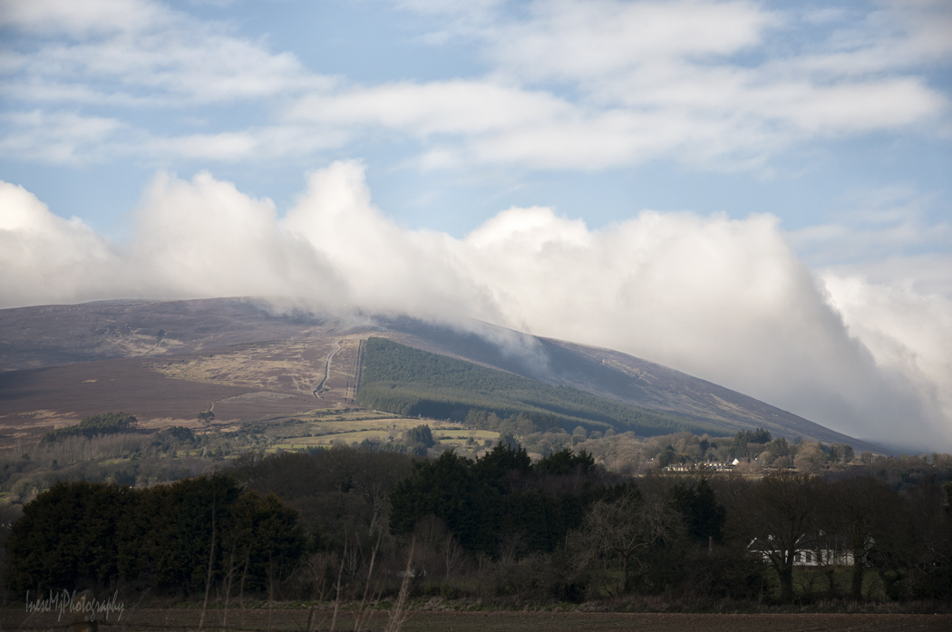
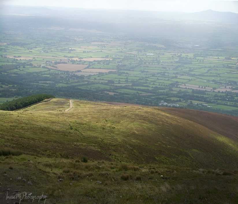
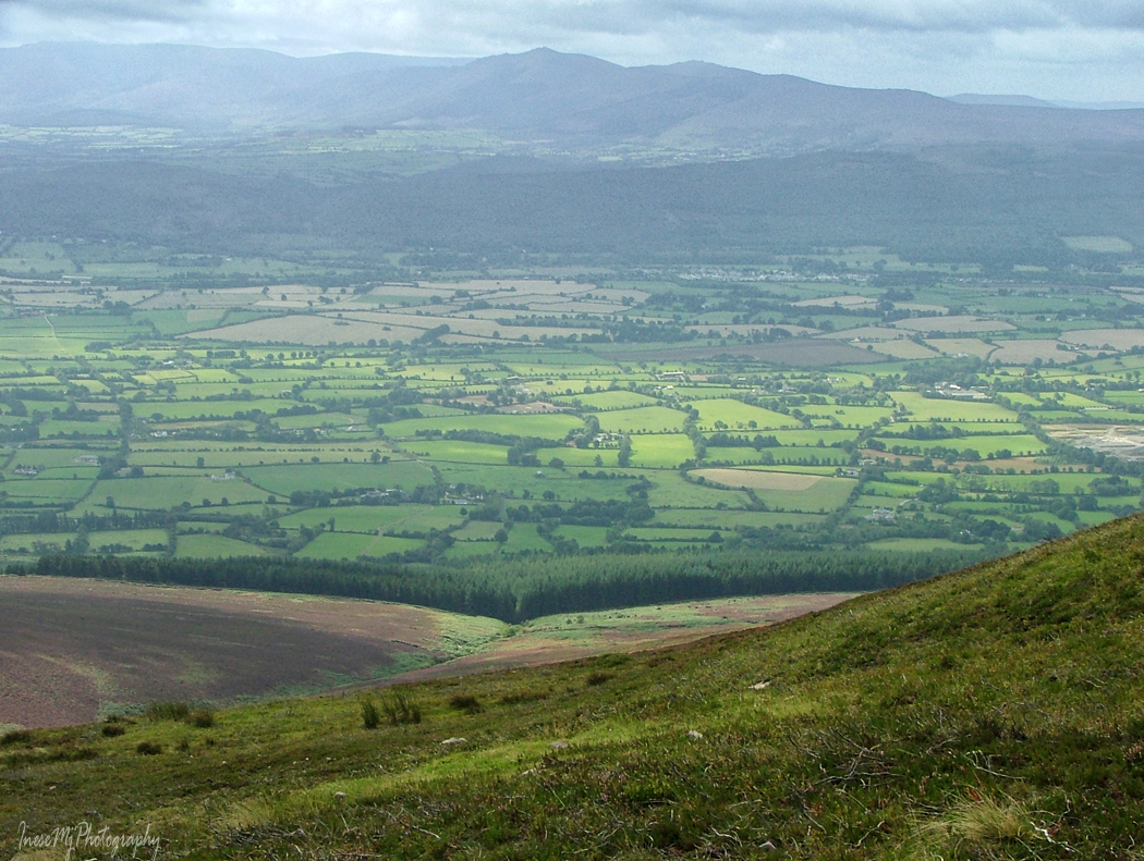
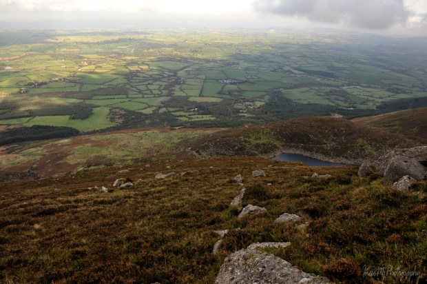
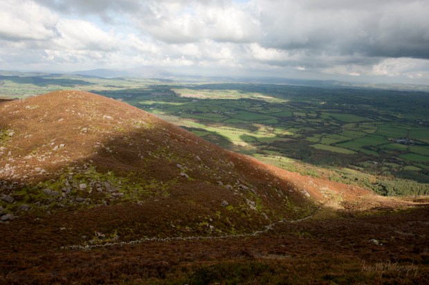
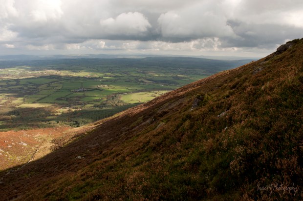
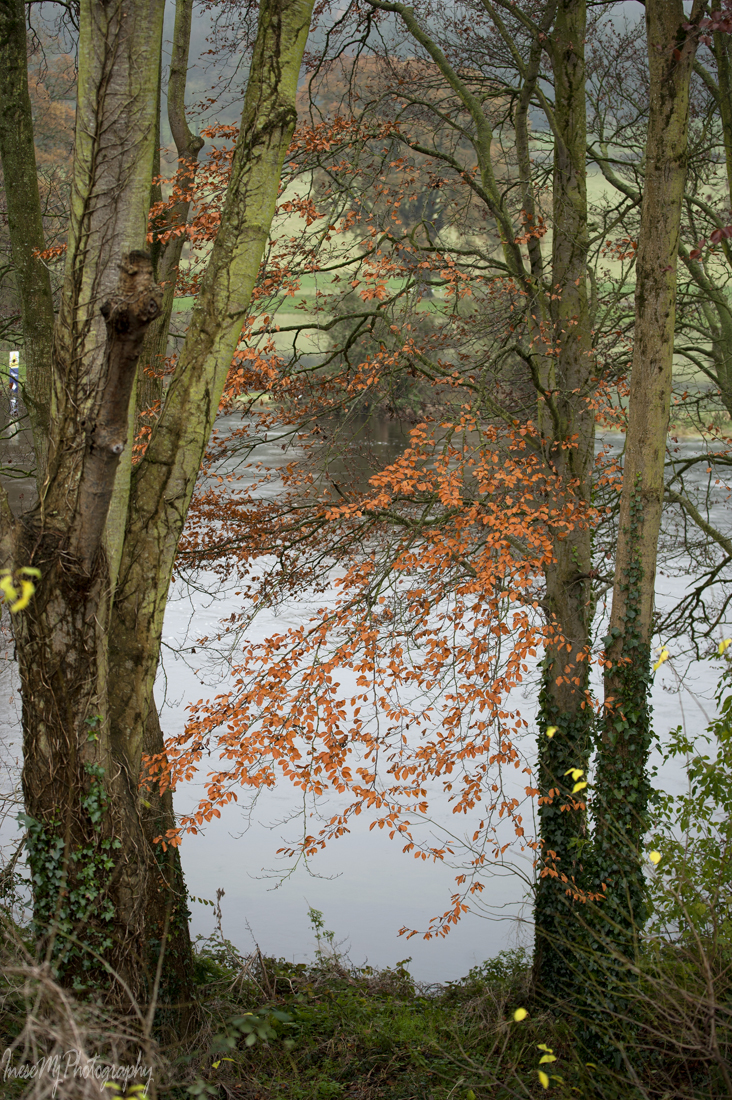
After a short break we continue our ascend to the lake. A beautiful view of the scenic valley between the cloud-clad Slievenamon and the Comeragh Mountains will follow you all the way up acquiring a map-like look as you climb higher.

In the picture below, you see the south end of the valley, a glimpse of Croughaun Hill on the right, and the Portlaw windmills in the skyline. What a view!

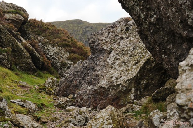
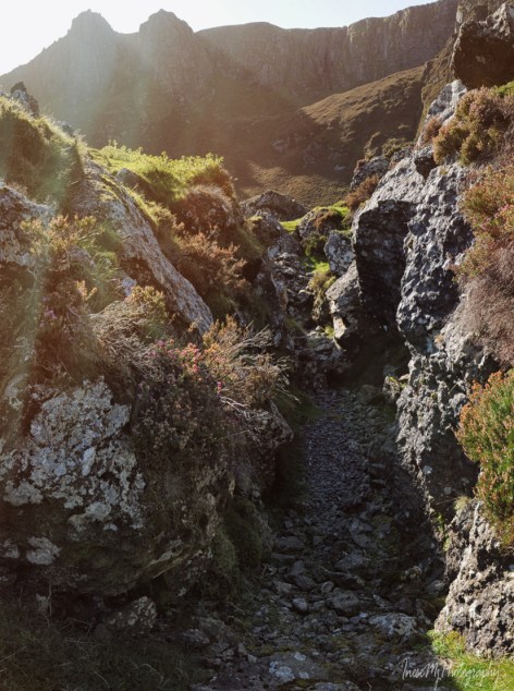
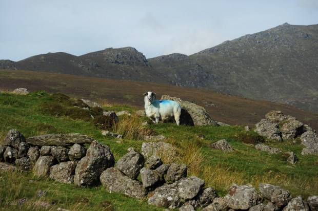
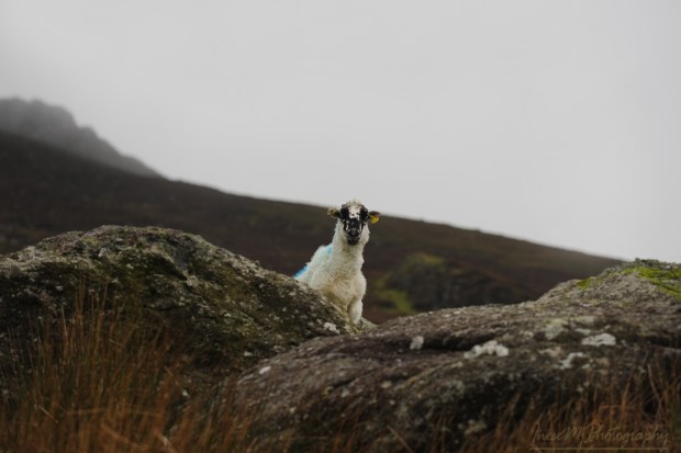
The bump on the top of this steep hill is The Ass’s Tail.  The Ass’s Ears (and the lake) are located right behind. Instead of struggling our way up, we will wisely follow the waymarks round the hill choosing the dry grass patches between the rocks and the sheep tracks to guide us through the heather.

There are three kinds of heather in the Comeraghs, of which only one is a real heather – Ling or Calluna vulgaris. The other two are Erica – Cross-leaved heath, and the Bell heather in the picture below. Erica have plump magenta-colored flowers.

I have read that heather can live for 30 years.

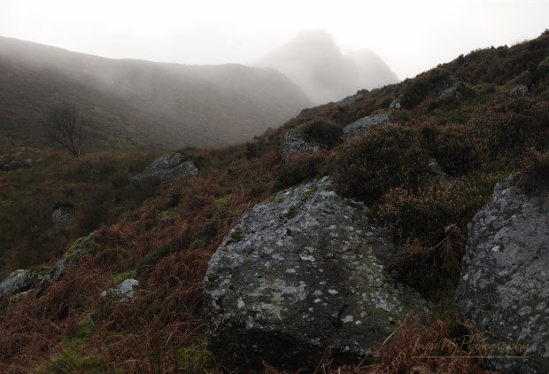
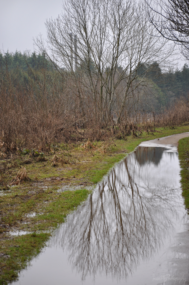
The Irish weather is not always dry and sunny. Be careful around the tiny streams emerging after the rain. The incline gets steeper here – slow down, stop and take a picture 😉

Nearly there! The last stretch is my favorite.

First you see a pair of pinnacles. That’s right, they are The Ass’s Ears.

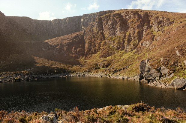
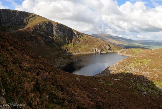
Then the lake itself appears, and it is like magic, especially when you see a redhead fairy taking a selfie.

We walk along the lake, taking in the majestic beauty of the rugged cliffs.

We will hike closer to the pinnacles to see the Crotty’s Rock.

First we take a short hike up the steep slope on the right side of the lake to get some views.

When taking this picture, I was the only human being as far as I could see in any direction.

We continue walking along the slope, sometimes with nothing more but narrow sheep tracks to help us through the thick heather.

Sometimes we need to switchback or walk around the rocks.

That’s high! 😊

Higher 😊

Now you can see The Crotty’s Rock on the top of the pinnacle.

Another hike, this time to the left side of the lake. From here we can see the Crotty’s cave. To get there, he had to swim and use a rope to lower himself under the ground level.

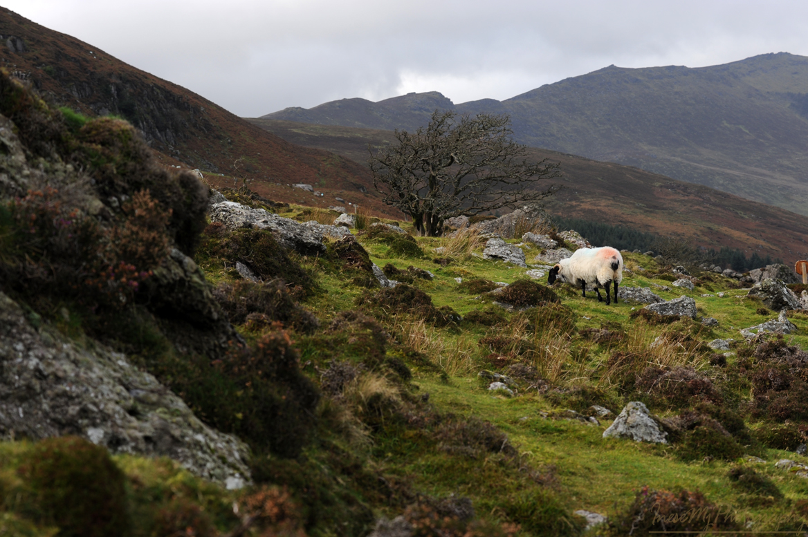
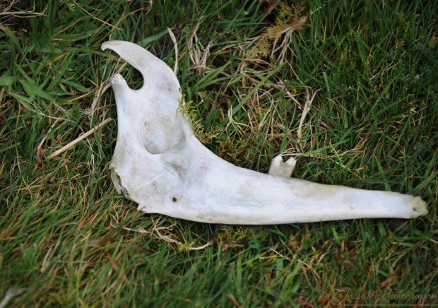
The slope is very steep here, and the sheep tracks are narrow and boggy. Do the sheep ever fall off the rocks? Yes, they do.

I found some parts of the sheep skeleton – mandible and a part of the cranium.
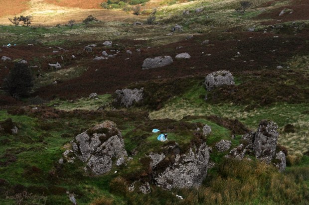
More views.

I hope this part of the Comeragh mountains won’t change. People don’t want to drive to this lake. They want to hike there. Those who come to Ireland are not looking for luxuries. They see value in unspoiled natural scenery, a special kind of adventure. My opponents always mention the Mahon Falls, Co Waterford, as an example of successful tourist destination, but it is different, it is a former turf cutting site. Comeragh mountain lakes are precious gems, and any attempt to make them ‘touristy’ takes their value away.

Thank you for being such great walking buddies. Next time we will visit another beautiful lake.

  Have a wonderful week!

Blue Way of County Tipperary V

The last leg of our walk begins. The season is early spring. Some old, pre-Blueway pictures from the other seasons are added just because I have hundreds of them 😉

I stop and look both directions down the winding path.

That’s how it looked only a few years ago. It was a refuge for the stressed-out humans and nesting place for birds. I loved it.

Fragrant Meadow Sweet used to grow waist-high at the water edge. It probably was there for millennium. A sacred herb to the Celts, it was used in potions to treat skin problems, and as a floor covering for warmth and hygiene.

And there are birds, of course. Chaffinches, robins and starlings are year-round residents in Ireland. Chaffinch is a long-living bird, and raises one brood each year.

Robin and starling live only 2-3 years, often even less, and raise three broods a year. I have seen robin fledglings in early October.

Halfway to our destination, there is a ruined church and graveyard we will visit some other day. The graveyard is the resting place of Catherine Isabella Osborne, an Irish artist and patron. She was interested in photography and supported William Despard Hemphill’s photography projects. He dedicated his collection of photographs of Clonmel to her in 1860.

Killaloan church looks timeless with majestic Slievenamon in background.

At the opposite side of the river, heather-clad slopes of the Comeraghs come into view. River Suir runs all the way along the Comeraghs and turns north near the village of Newcastle at the foot of the Knockmealdowns.

We walk past a memorial stela and stone bench. The memorial was erected by the family of Peter Britton who along with his climbing partner Colm Ennis died in a fall in the French Alps in 2014. Mr. Britton was the Senior Roads Engineer with Tipperary County Council remembered for his role in the Blueway project.

River Anner, a tributary, slips under the bridge into River Suir.

It is not unusual to see Clonmel Riding Club members on the towpath…

…but the galloping ponies on the opposite bank came as a surprise.

We are approaching another beautiful landmark – Sir Thomas’s Bridge. This six-arch humpback bridge was built in 1690 by Sir Thomas Osborne who had lands on both sides of the river. He resided in the three-story Tudor style house built almost a century earlier by Alexander Power.

This is a closer look at the house. It is often called Tickincor Castle and has been in ruin since the 19th century.

A view of Sir Thomas’s bridge from the opposite bank. The same as Kilsheelan bridge, it has a dry arch for pedestrian use. The bridge has never been widened or altered in any way.

Another interesting fact about Sir Thomas’s bridge is that in the times of horse-towing, the whole team had to enter the river to pass underneath the arch. Accidents happened and the boats got wrecked there.

Another view from the opposite bank. You can appreciate the height of the arches.

Clonmel river walk existed way before the Blueway was launched.

There is a set of weirs on this stretch of the river, some of them overgrown. They used to supply the water wheels for the number of mills. Here is a poem about the Gwendoline boat accident at the long Dudley’s weir.

A heron took off, slipped on landing but regained his balance. Funny bird, I never get bored watching them.

Hotel Minella is another landmark. The central building (1863) was built for Thomas Malcolmson of the famous Malcolmson family I mentioned in my blog before. The Malcolmsons represented the finest example of capitalism in action. As per The Irish Times, August 18, 1865, Mr. David Malcolmson shared his thoughts about the self reliance and welfare: ‘The best mode of preventing emigration would be to provide proper dwellings for the peasantry, and to give every labourer a savings’ bank outside his own door in the shape of an acre or half an acre of land.’ 

This is the flooded Clonmel in 2009. The five-arch Gashouse bridge (1825) has two already familiar pedestrian dry arches – one on each side of the river, but there is also a dry path for the horse-towing under the navigation arch. Very interesting features are the bollards I have circled in red in the picture. They are made of cement, and have deep rope marks.

The towpath ends here. We will walk a little further.

This is where our walk ends – the Old Bridge, Clonmel. Actually the Old Bridge is a group of bridges spanning two existing branches of River Suir and one former branch which is dry now.

A view from the bridge during the 2009 flood.

After that flood the wall was built. No, it doesn’t stay this way all the time, thankfully.

Beautiful River Suir – walled, paved, but not tamed.

I am sharing a link to one of my favorite blogs. Here you can watch a slideshow to find out what the river looks like from a boat. Thank you Brian for all your fantastic articles!

Here is an article about a person who doesn’t support the development of the Blueways, and I clearly see her point. It is about River Barrow, one of the ‘Three Sisters’ – Barrow, Suir and Nore. What happens next is still uncertain. The owners of the local businesses are the strongest supporters, but in my opinion, South-East doesn’t need more Blueways. River Barrow in its natural beauty will attract even more visitors in the future. Maintaining the grassy towpath and leaving all the mature trees be is the best investment one can make. Mr. Malcolmson would approve 😉

Thank you for being such wonderful walking companions!

Have a happy weekend!

Blue way of County Tipperary IV

I don’t want to leave the village of Kilsheelan yet! Today’s walk is about a half of a mile long. We will be mostly standing and looking at things through all four seasons of photographs.

George Henry Bassett, an editor of the New York Times with an interest for writing, left his account about Kilsheelan in his Guide and Directory, 1889:

“… Kilsheelan is a station on the Waterford and Limerick railway… The land is good for pasture and tillage… The Waterford county border is separated from Kilsheelan by the river crossed here by a substantial stone bridge. Near it there is a quay for discharge of goods dispatched by boat from Clonmel, Carrick-on-Suir and Waterford. At the verge of the river, close to the bridge, there is an ancient moat. It is now quite bare, but down to fifteen years ago, had a good covering of trees. The ruin of an old church between the village and the river, is one of the striking objects seen from passing trains…”

We will find these object – and some more- 130 years later.

Elegant yet sturdy Kilsheelan Bridge spans the river since 1820. The bridge has three large arches and one additional dry arch for pedestrian use and boat towing. The bridge was repaired and expanded in the late 1930-s.

The bridge in November 2019.

This is the place where the quay used to be.

Another object from the book is the famous ruin of Kilsheelan Old Church. To get there, we walk past the Butterfly Garden.  It is a lovely place to meditate and enjoy the sun. The Garden got a new gate last summer, beautifully decorated with the otter, swan, salmon and kingfisher wood carvings.

Kilsheelan means ‘the church of Síoláin’, an early saint who died in 608 or 610. All photographs of the ruin look the same, so I was glad when a black & white kitty came into the frame and added some ‘color’.

Kilsheelan Old Church ruin dates from the early-twelfth century. The west gable and the south wall are pre-Norman. 

The bell cote and this ogee headed window were added in the 15th century.

The east gable.

In the north wall, there is a carved Romanesque doorway – usually such doorways face West. You can read about a fine example of Romanesque doorway in my blog about The Saint Lachtain’s Church of Freshford.

The Church was probably abandoned in the 16th century, but the graveyard guarded by ancient yew trees is still in use. There are many 18th century tombstones and headstones.

The opposite bank is bursting with life: I have seen otters, kingfishers, water rails, dippers, and of course there is always a heron.

There is also a lot to see at the village end of the bridge.

First of all, the majestic Slievenamon, sometimes covered with snow. This beautiful mountain is always in view. On the right side of the image there is another interesting object – a Norman motte, an earth and timber fortification.

A grotto was built into the north side of the motte in 1948.

This is the latest addition to the village’s image.

The views from the bridge, downstream and upstream.

There are two mature birch trees between the motte and the river. Treecreepers can be seen there spiraling up the trunks, completely ignoring a human and her camera.

Former moat still isn’t entirely bare, looking lovely in autumn colours.

We walk upstream from the bridge to get to Castle Gurteen de la Poer before the dark.

The owner of the castle is Gottfried Helnwein , an Austrian-Irish artist. He resides there with his family.

My plan was to ask the residents of both Poulakerry and Gurteen if they ever walked, cycled or kayaked all 21 km of the Blueway. I didn’t have an opportunity to see the Poulakerry folks, but I asked my question to Cyril Helnwein – fine art photographer, motorcycle enthusiast and the resident of Gurteen de la Poer. Yes, they have done it many times as a family, he says. Both cycled and kayaked. They sure love ‘wind in their hair’. This Sunday Cyril is riding solo in The Distinguished Gentleman’s Ride, and those of you who are passionate for bikes can visit Motowitch Collective website his wife Kojii Helnwein hosts since 2018.

We are moving closer to the end of our walk. Only 8 kilometres left, and I hope we make it to Clonmel in two weeks. Thank you for being my walking companions!

Here is a link to one of my blogs about Gottfried Helnwein’s work.

  Have a happy weekend!

Comeragh Mountains

comeragh

Today we will do a bit of hill walking as most of us have consumed those extra calories between the Christmas and New Year day 😉 Comeragh Mountains is a good place to start since you have already seen them from the top of beautiful Slievenamon. Here she is, my favorite mountain, as seen from the ascent to the Long Hill of the Comeraghs. First of all we will find the source of peculiar clouds that look so nice in the photographs, so let’s walk towards Slievenamon and have a closer look.

slievenamon

I always blamed Bulmers for the clouds – or Magners, as the product is called outside of Ireland. Famous Irish Cider brewery and the cloud maker, a timber company Medite, are situated in close proximity. Now the justice is restored thanks to the reader who pointed out my mistake.

bulmers

bulmers

Dramatic clouds enhance your photographs, but is this steam emission harmless? I don’t know.

comeragh

The Comeraghs are formed by twelve mountains and various hills. They are located between Clonmel, Ballymacarbry, Dungarvan and Rathgormack. The highest point is at 792m ( 2,598 ft). In the photograph below you see the foothills of the Comeraghs from Clonmel side of the mountains. The upper part of the hills is wrapped in a tick cloud.

comeragh

This picture was taken in March. The setting sun colored the tops of the bare trees and made them look like autumn foliage.

comeragh

You are standing on the top of Scrouthea Hill – Cnoc a Chomortais. To get there you walked from Clonmel town all the way up, catching your breath and feeling lightheaded. Well, you can also drive most of the way. If it is an August Bank Holiday, another thousand people are walking up the hill beside you, partaking in the annual tradition of The Holy Year Cross Walk. The Holy Year Cross was erected in 1950. The original timber cross was carried by fifteen strong men.

I hope you already recognised the mountain in background 🙂

comeragh

From here you will walk south.  The picture gives impression of a rather flat surface. In fact, the descent and the following ascent are quite steep. All the brown-colored area is infamous Comeragh bog.  It is wet all the year round.

comeragh

In summer, the bog turns purple with the blooming heather.


Before you continue uphill to the crest of the Long Hill, walk off the main path to visit the abandoned farmstead that used to be a home to the Ireland family.

comeraghs

The Ireland family farmstead is the most tranquil place I have ever visited.  You will spend at least an hour around the farmstead reflecting and meditating, taking photographs and enjoying the beauty and serenity. Only a hiking club party might disturb your peace, but this seldom happens. A lone hiker will more likely wait until you leave, and come down later.

comeragh

comeragh

comeragh

After walking through the bog you will appreciate the flat, firm and dry land and silky grass of this oasis.  How sad it is that the family had to desert their home and fields as they had given up the struggle to work the land.

By the way, the Ireland children had to climb the hill to attend the school in Clonmel.

09-264

Leaving the oasis you continue uphill through the bog to the summit of the Long Hill ( just for a spectacular view), keep walking south until you reach Lachtnafrankee mountain, and then a steep ascent takes you to Glenary river valley.

Across the river, there are remains of Glenary village. This was a street with the houses on the riverside and the fields on the hillside.

Glenary

The village mostly consisted of clochans – clusters of houses with a shared entrance and farmyard.

09-209

It is difficult to believe that the last inhabitant left the village in the 1960s. His house had thatched roof and red door. It only took a few decades for the Nature to consume the buildings so that some of them literally disappeared.

09-208

glenary

Glenary with Long Hill and Laghtnafrankee mountain in background.

9-181

gorse

The view from the hillside over the valley. Carey Castle I recently wrote about is in the woods behind the cottage.

comeragh

To return to the Cross you climb a steep and muddy track – you will need your Wellies for that. A herd of cattle walk in the deep mud twice a day, which doesn’t improve the surface of the track. This is the view from the top. The Cross is on your left, but it is not visible from here.

comeragh

These photographs are 8-10 years old. I have no time to return to the Glenary Valley, but I visit Carey Castle every year.

It was a long walk but we only covered a tiny part of the mountains.

map


I am taking a break, and hope you will be in a good form to continue hiking in the Comeraghs in two weeks from now. Meanwhile, I will repost some of my old stuff from 2014.

inesemjphotography Have a wonderful January!

Slievenamon

slievenamon

Before Christmas, I want to squeeze in a blog about the most beautiful mountain in Co. Tipperary – Sliabh na mBan, or Slievenamon. In the ancient times, when the slopes of the mountain were covered with forest of hazel, beech, oak and alder, young giant warrior Fionn mac Cumhaill went out hunting deer. It is when he met Sadhbh, the daughter of the magician Dearg,  in a form of a white doe. Sadhbh was turned into a deer by a druid Fear Doirich – Dark Man – whom she refused to marry.

The forest is long gone, but the magic remains. Slievenamon has a troubled history, and who knows, may be the Dark Man is to blame.

When driving from Clonmel to Waterford and back, Slievenamon is always in your sight. Seasons change, but Slievenamon doesn’t.

slievenamon

slievenamon

The only change is an occasional layer of snow on the top.

There are a few cute little villages at the foot of Slievenamon. Kilcash is the one from where Slievenamon can be climbed. Another place to visit in Kilcash is Medieval church and graveyard, and the ruins of the Butler Castle behind it.

kilcash church

kilcash graveyard

Standing in the graveyard, I look at the path I am going to take to reach the summit.

slievenamon

For a fit local resident climbing Slievenamon is a piece of cake, and it takes less than 50 minutes ( elevation 2,365 ft, climb 1500 ft ). People walk there with their dogs.  I have been to the summit only once, when I was much younger. Since then I was only able to make it to the stone wall half way to the summit. The good news – you won’t get lost because there is a distinct track.

y2013-006-19-064

slievenamon

slievenamon

slievenamon

Waterford bridge is 40 km away, but I can clearly see it.

Closer to the summit, it is cold and misty.

slievenamon

The ‘false summit’ – rather flat, with a pile of rocks (cairn) in the middle ( I am standing on it). Some people pick up a rock at the foot of the mountain and take it to the cairn to add to the pile. I was barely able to take myself up there… The cairn marks an entrance to the underworld, they say. Who knows. A less distinct path takes me a few meters higher to the real summit. Unfortunately I have lost the photograph. There is a waist-high standing stone up there.

slievenamon

On the other side of the valley there are beautiful Comeragh Mountains. I will write about them in January.

slievenamon

Always nice to see  a friendly face. Walking down the mountain does not take that long.

yy2013-175_1

And here is a famous Irish song Slievenamon for you to enjoy.

I share a link to the blog Walking in Sonoma County…mostly , and also to La Audacia de Aquiles mythology blog. Please visit and follow 🙂 I will be back with more historical facts and myths about this beautiful mountain.

www.inesemjphotography.comHave a wonderful weekend!