The Ring of Kerry

A Day Trip to Kerry: driving the Ring

Today we are rounding up our trip. In the next 5 hours we will drive the Ring of Kerry and return to your hotel in Killarney. Half way through the journey, we will stop for a dinner and meet two celebrities. Oh, speaking about celebrities…

Recently our talented blogger friend Resa McConaghy from  Art Gowns blog created a gorgeous art gown Contessa Fiori

Photo © Art Gowns

Contessa demanded a castle, and picked the one from my blog. I cannot tell you how honored I feel. My first thought was to invite the beautiful Contessa and the other Art Gowns to join us on this trip, but then I realised that we are traveling on a budget… So I arranged a yacht for Contessa Fiori and the other exquisite Art Gowns. They took off from Valentia island, and are on their way to the Puffin island right now – which is a counterclockwise journey. We will be traveling clockwise – don’t be confused by the online disputes about the right direction. Most of these disputes started before the roads were improved, and if you do get stuck behind a slow vehicle, it is only because of your bad luck on that particular day. This can happen on both directions.

Meanwhile, please visit Resa’s blog to admire her art.


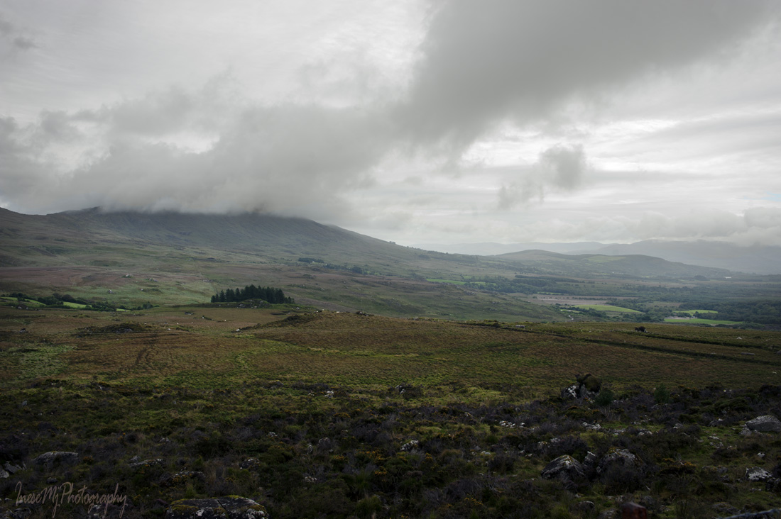
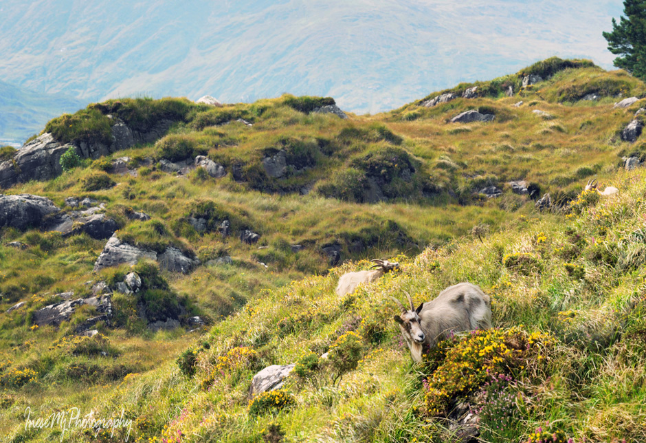
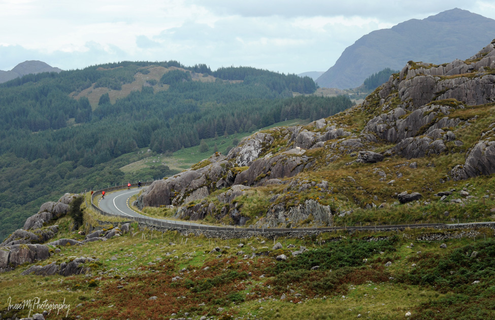
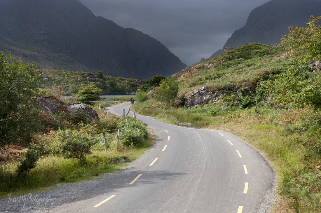
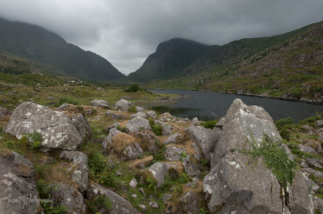
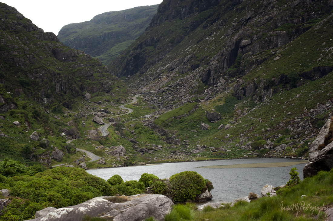
There are two ways to drive the Ring of Kerry from Kenmare.  Some of you might prefer driving west by N70, which is perfectly fine. You will pass some cute villages and drive very close to the sea edge for a minute, but I’d rather go back to the Molls Gap and enjoy the 10 km scenic drive one more time. Then I will take the northern route R568 from the Molls Gap towards Sneem. We will meet in Sneem in a half an hour.

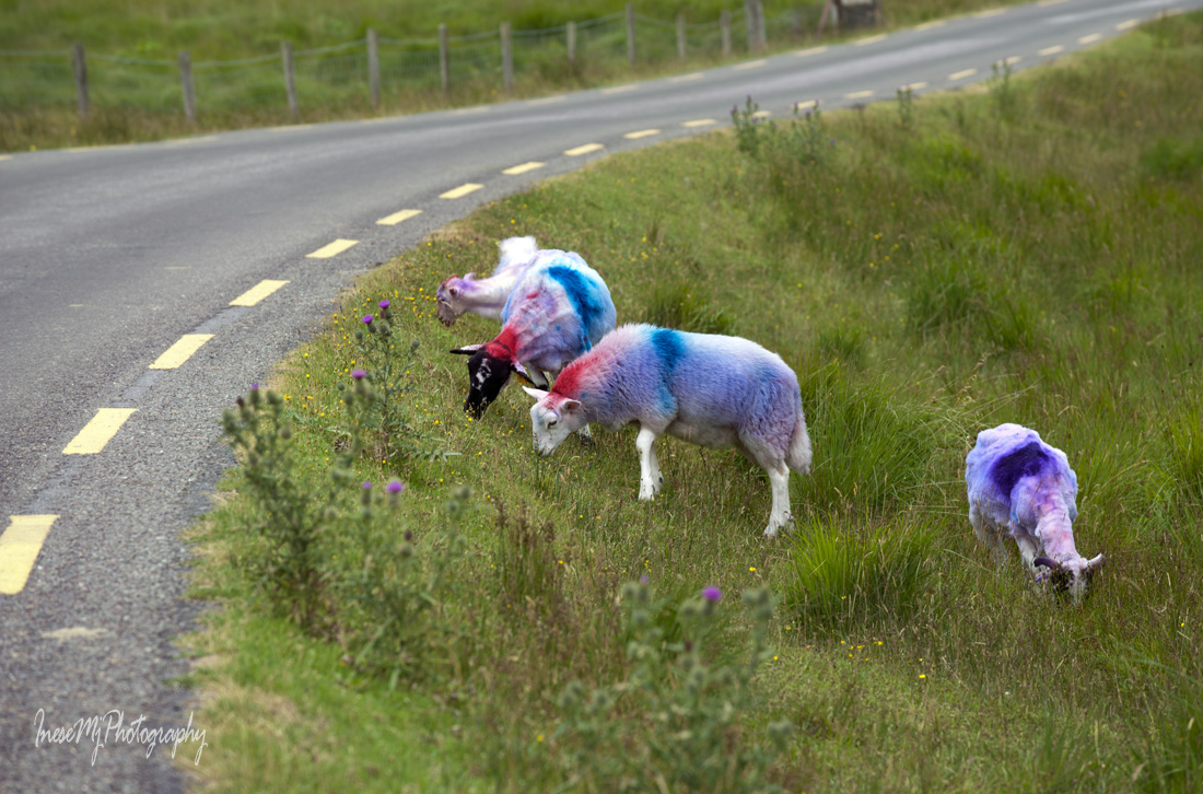
I like the northern route because of its rugged scenery and a chance to see sheep, horses and goats ( they are a great addition to any picture).

The Ring of Kerry

This round object looks like a lost tennis ball, but it is not. It is a cute colony of fine moss.

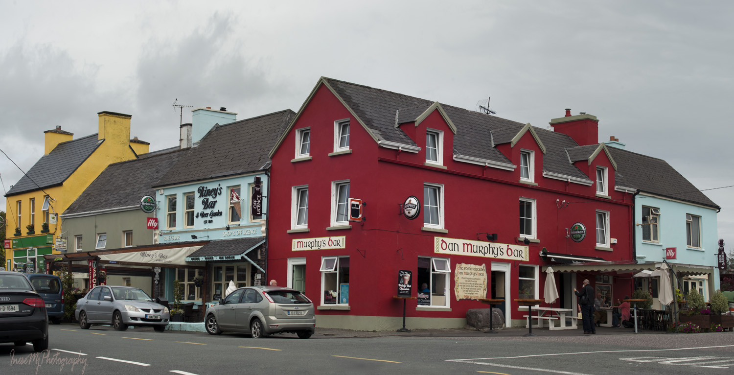
We meet at the Murphy’s Bar in Sneem. If you have more time, you might want to stay in Sneem for a couple of days. There is so much to do. 

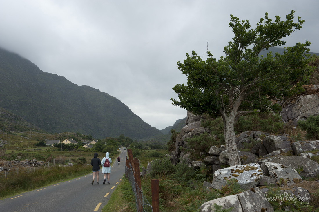
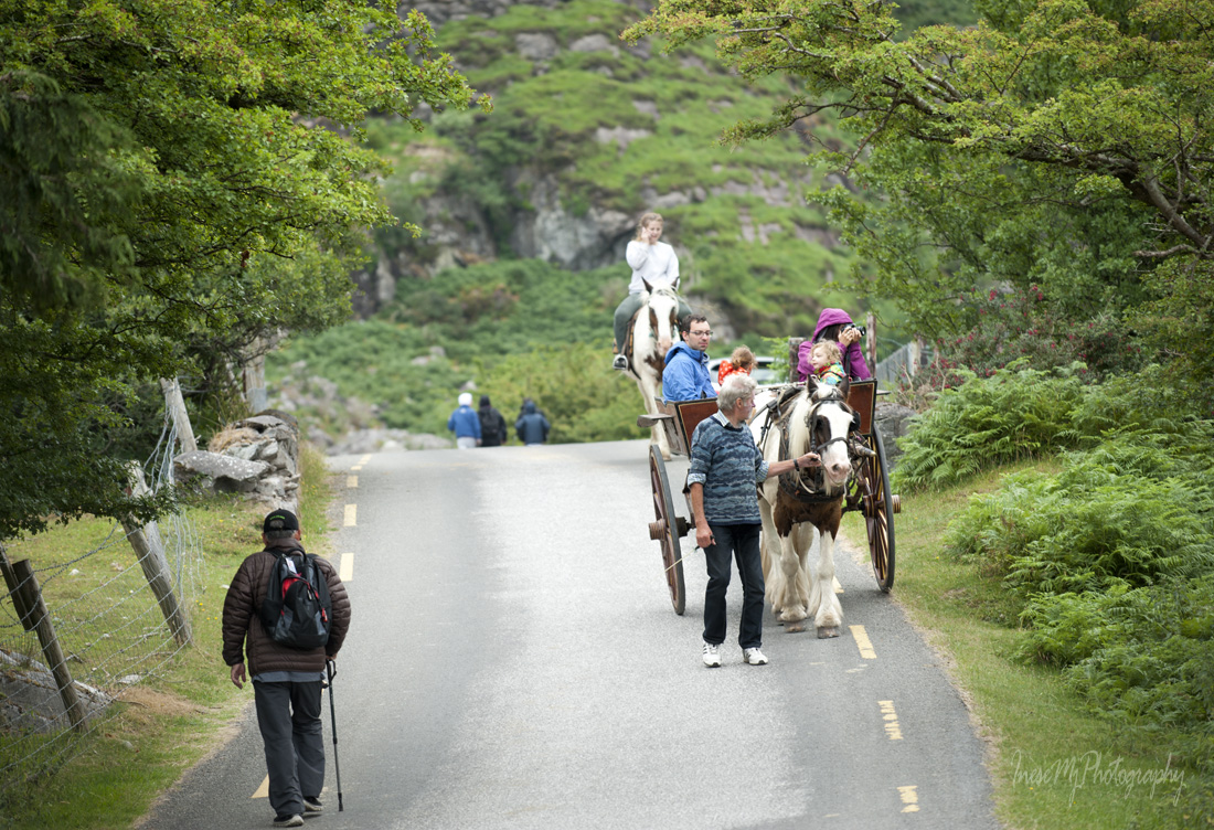
We continue driving for another hour, stopping at the pull-offs.

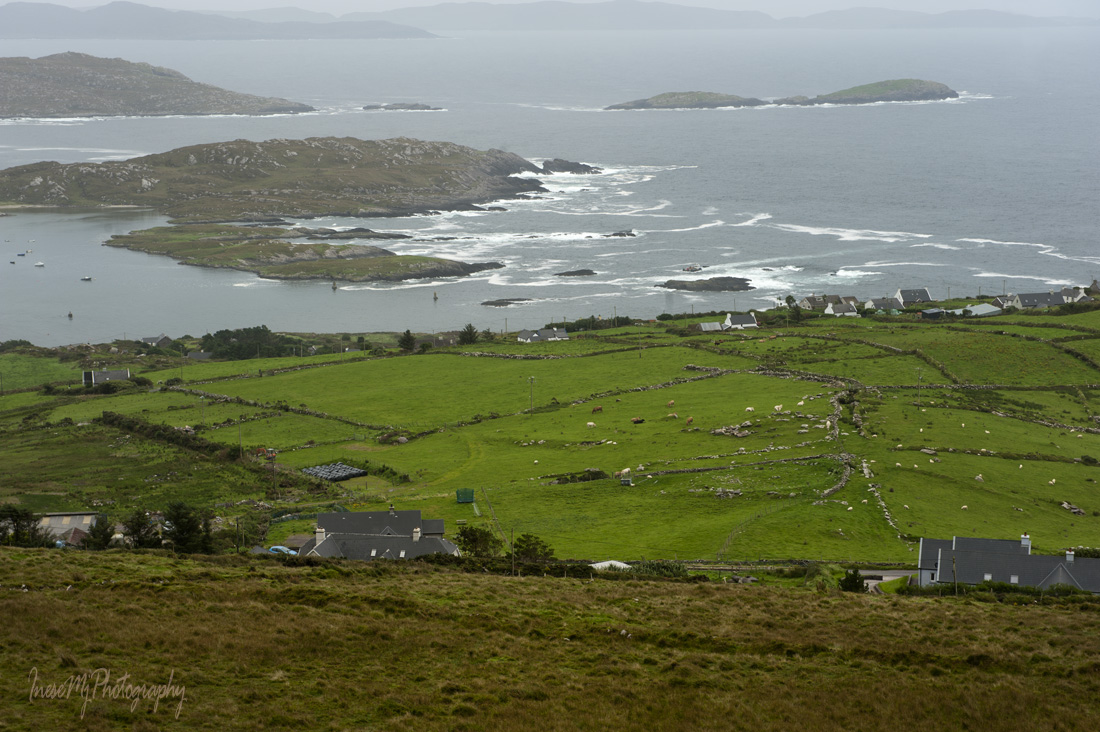
Now we have reached the Coomakista Pass. After this large bend and before we start our descent to Waterville, there is a large parking lot where we will stop for a minute.

The rain starts picking up, but the view is beautiful nevertheless.

Statue of the Virgin Mary called the Lady of Wayside, was erected in 1954. Some articles say that the statue is overlooking the Ballinskellig bay, which is not true. The Lady is facing the road, and looks down.

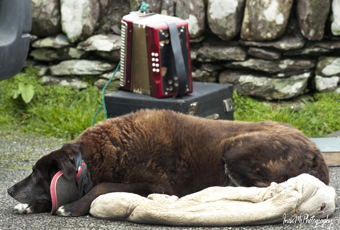
There is a man selling hand-woven St. Brigid’s crosses for €3, a bargain. The crosses are made from rushes, and will dry very soon, but they look so lovely. Probably every Irish family has a Brigid. The crosses are supposed to be made and hung over a door on the February 1, St. Brigid’s Day, but it won’t do any harm if I get one now.

Before I open my mouth to ask for a photograph, the man retires to his van and unwraps a sandwich. I don’t wait for him to return, and take a picture of his dog and his accordion.

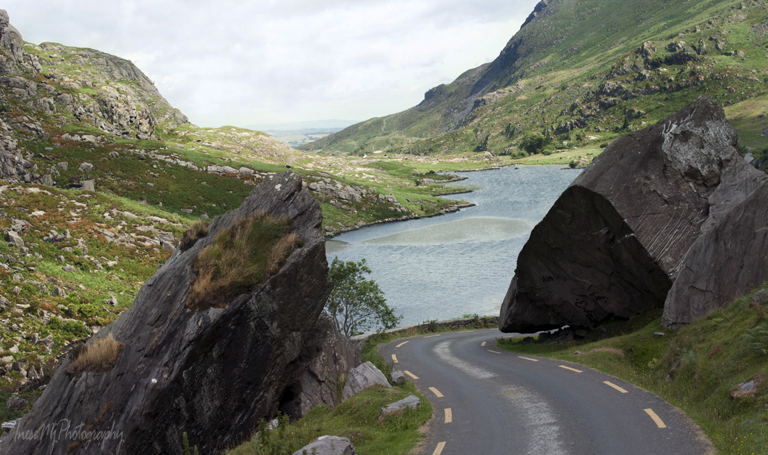
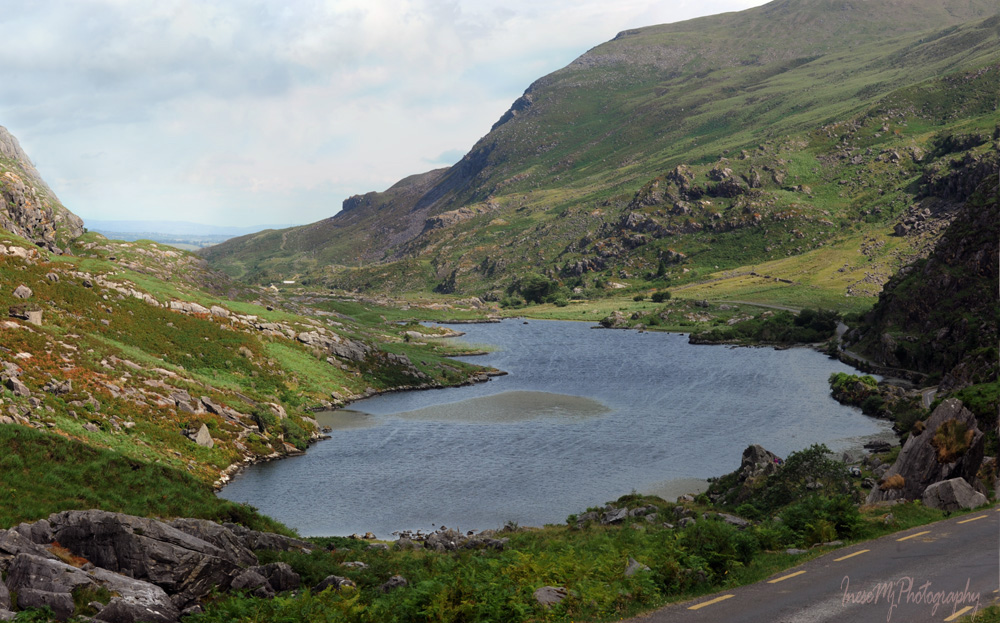
We are about to start the most beautiful descent. Thankfully, there are a few spots to stop and enjoy the view.  Our clockwise drive allows us to be closer to the edge (we are driving on the left side you now), which is also a bonus.

And now, the drum roll..! (Well, some bird photographers will roll their eyes and say ‘she did her best’) Anyway, this is indeed the best (and the only) picture I took of a Red-billed chough.

Choughs are often heard before they are seen. This was exactly the case. I was deep in photographing a fuchsia at the roadside, when I heard the distinctive call and almost dropped my camera. The chough was flying quite high, and it was clear that the bird has no intention to land. I lifted up my camera and this is what I got.

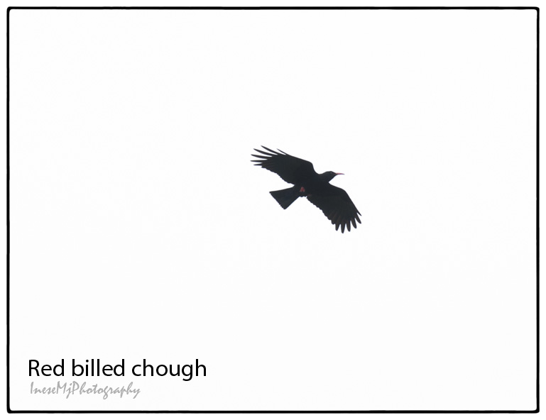
You can tell that it is a chough by the deep primary feathers that look like ‘fingers’, and also the red legs and bill. When choughs fly in a group, they sometimes perform stunts – like flying upside down. This amazing bird is endemic to Ireland, Isle of Man, and the far West of Wales and Scotland. The last Cornish chough died in 1973, but a pair have appeared and settled in Cornwall in 2001. Now their numbers grow. There are another seven subspecies of Red billed chough around the world. In some countries, the bird is depicted on postage stamps, including the Gambia, where the bird does not actually occur.

We finally arrive to the village of Waterville.

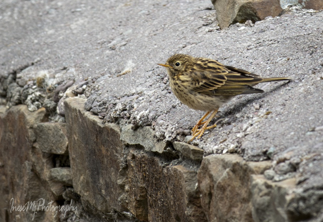
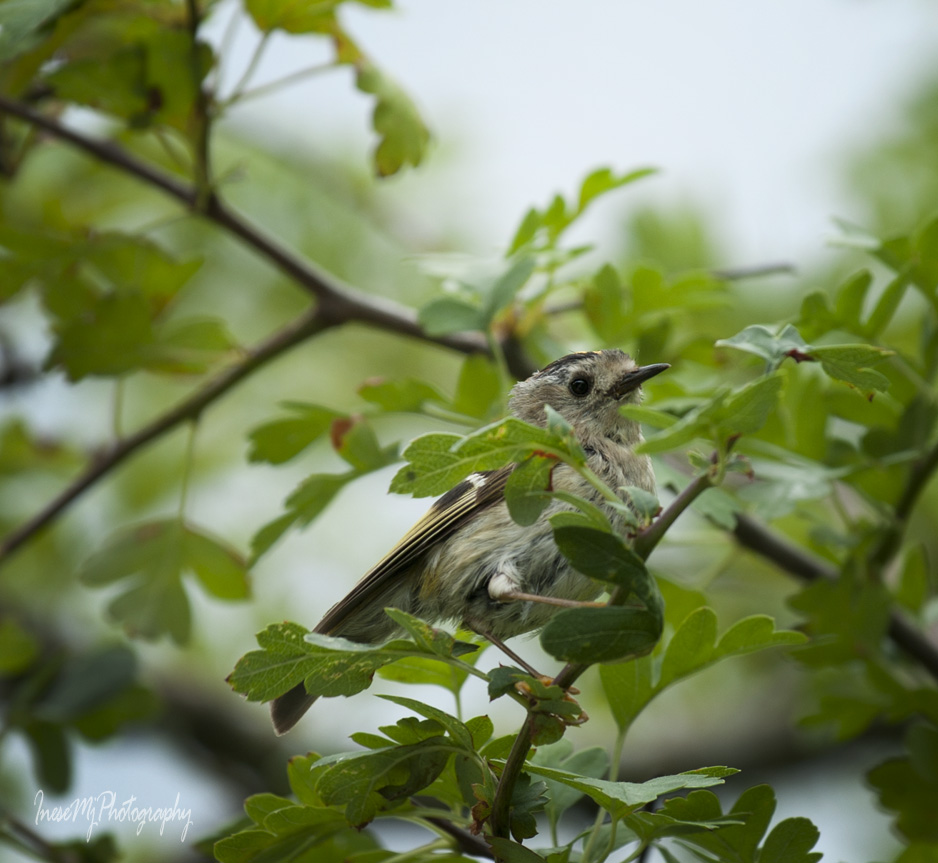
A lovely promenade that runs along the shore is a nice place to stretch your legs after the long drive. And there are birds!

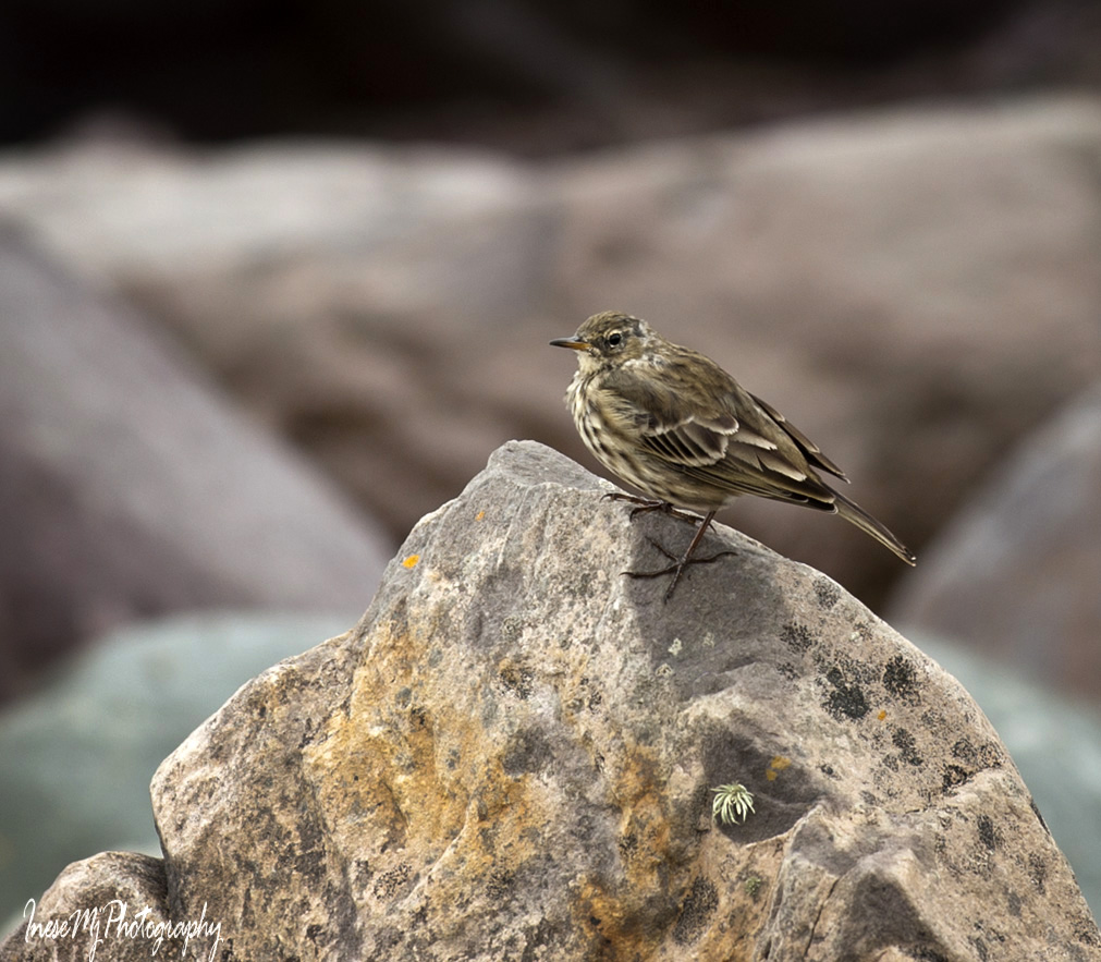
Rock pipit keeps an eye on me.

It is a time for a meal. This little village is tourist-centered, and we won’t have problems finding a place to enjoy some deliciously prepared seafood. Read the most relevant reviews, but don’t get discouraged by those whose reviews sound like a script for stand-up. The Lobster is my favorite.

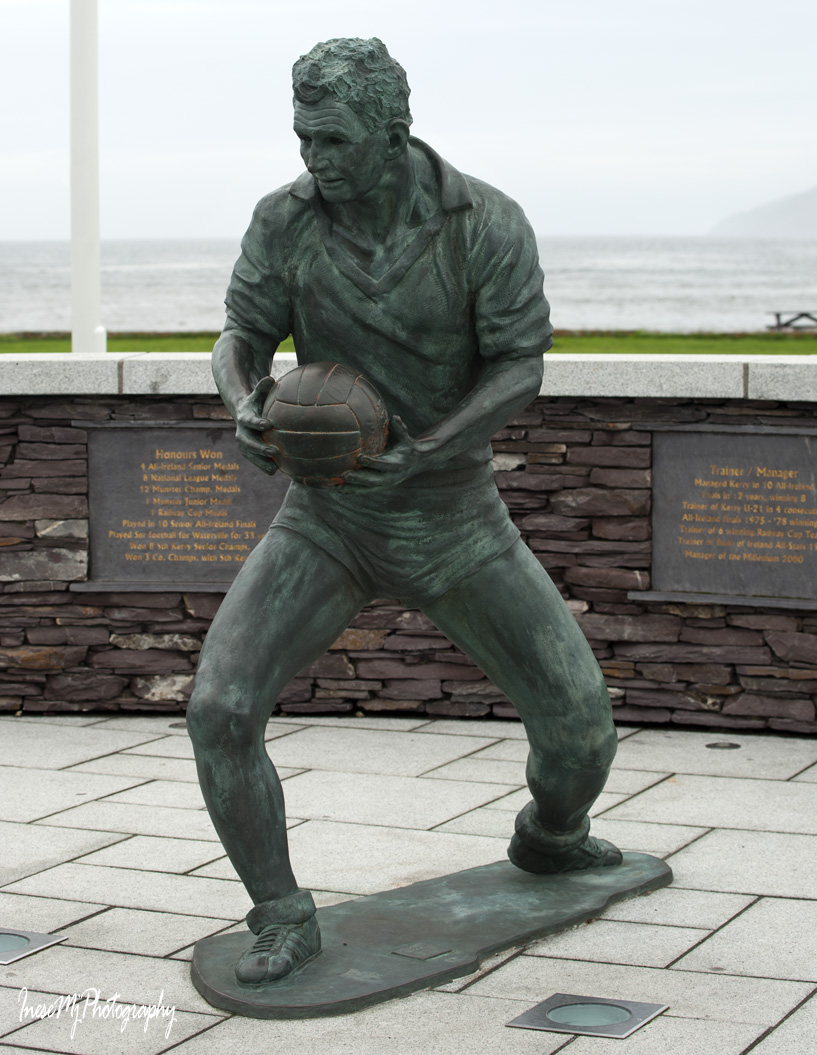
A few words about two bronze cast statues with Ballinskellig Bay in background. They stand close to each other, and both are dear to the hearts of the villagers.

The famous Little Tramp statue was unveiled in July 1998, and since 2011, Waterville has been holding an annual Charlie Chaplin Comedy Film festival in the end of August.

How did the Little Tramp end up in Waterville? On their first visit back in the 1950s, Charlie Chaplin and his large family came to Waterville and were turned away by a porter at the Butler Arms Hotel as there were no vacancies. The Chaplins humbly boarded their car and drove off to Kenmare. The owner of the Butler Arms, alarmed by someone with a greater knowledge about celebrities, rushed behind them catching up just a few miles beyond the town. He took them back and accommodated them in his family quarters. For the following decade, Waterville became their holiday village, and today the Chaplin’s children and grandchildren still enjoy Waterville and the old friendships.

Football legend Mick O’Dwayer first saw Charlie Chaplin in the 1950s and hardly believed that the elderly white-haired gentleman was that famous funny character dressed in a tight jacket and baggy pants.

Mick O’Dwayer is 82, and it was a surprise for him to be immortalized in bronze. “Normally they wait until someone is dead before they do something like this” he joked at the opening ceremony in 2012. They call him ‘the uncrowned King of Kerry’ for a good reason.

We leave Waterville and resume our journey. When you visit next time, I encourage you to make a deviation from the Ring route and stay a day somewhere on the Iveragh Peninsula so that you can travel to Valentia island, and the beautiful Skellig islands. You might want to google the latest information on boat tours before you make your plans.

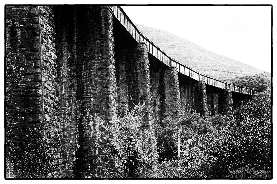
We pass the eleven span Gleensk Viaduct that was a part of the Great Southern and Western Railway Line. Closed in 1960, the railroad could be a stellar tourist attraction these days with all the spectacular views. Unfortunately it won’t happen. The railway was dismantled, some bridges closed, and even hiking on some section of the former railway is not advised. Construction of a 5.7 km long greenway near Cahersiveen has been discussed since 2013. If you are interested in hiking, here is a great list of trails.

The viaduct is worth a short stop ( there is a place to park right under the pylons, but remember that you are driving on the left side and be careful making the right turn). You can also park a short distance away and walk back to take a picture like the one above.


A video for those who are forever in love with trains and railroad tracks.

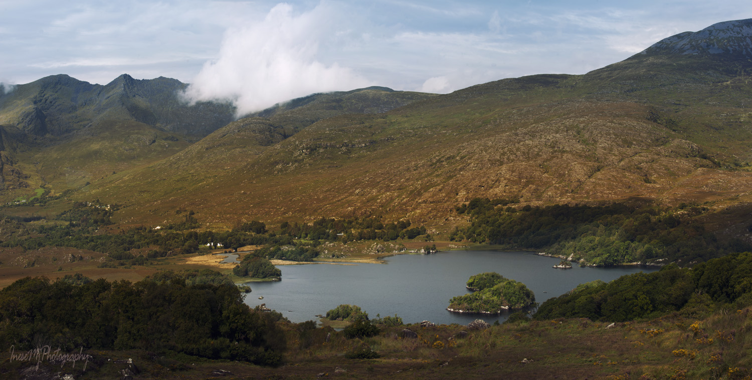
The railway line from Farranfore to Valentia harbour has two tunnels at Drung Hill. You can see them if you stop in the place where these two pictures were taken. There is an ample parking lot and the view is breathtaking.

Dingle peninsula on the other side.

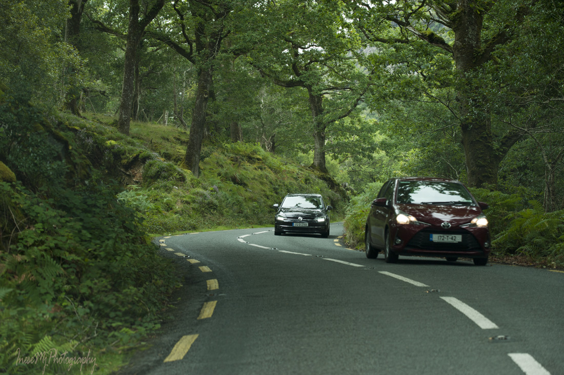
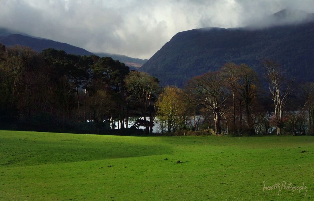
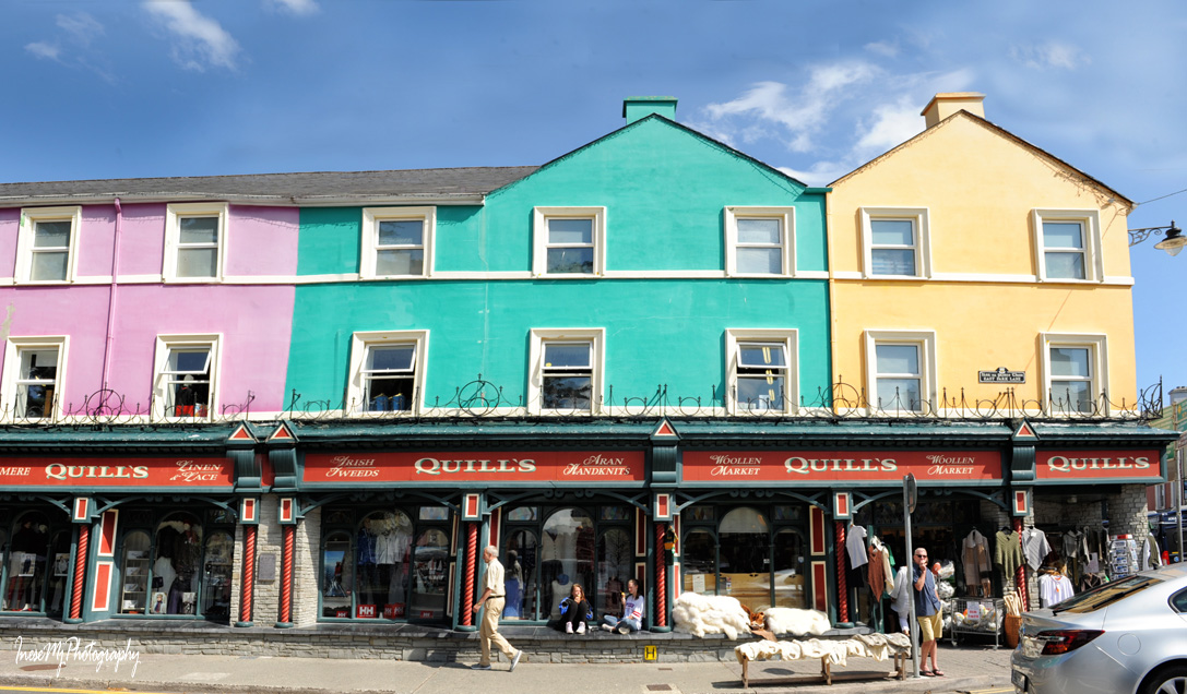
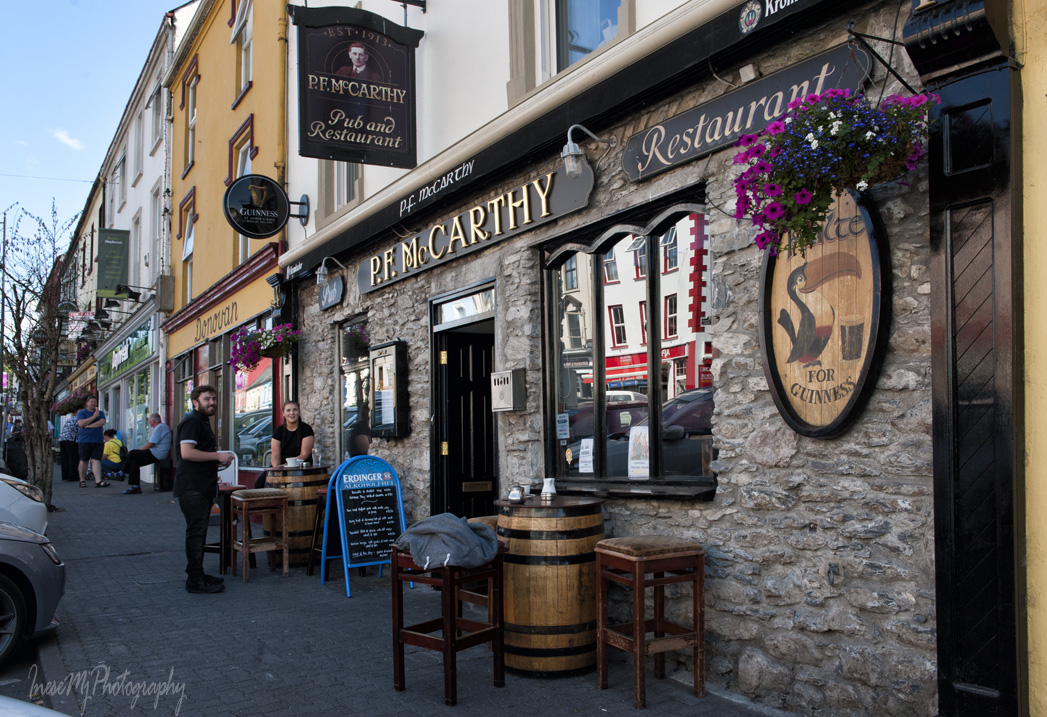
The rest of the Ring is not that spectacular, but lovely. We stop at this neat shop, and then drive straight to Killorglin.

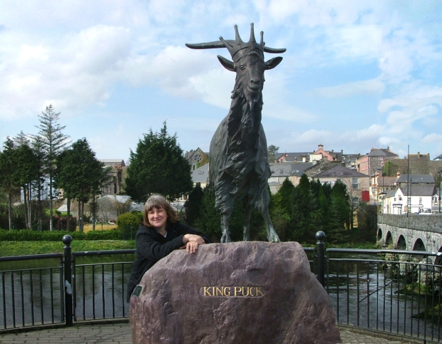
After crossing the bridge, drive  through the roundabout and park for a minute so that you can walk back to the river and take a picture of the King Puck from across the road ( read about the King in this blog post) That’s young me there in the picture 🙂 Didn’t have a chance to stay in Killorgleen any longer.

king puck

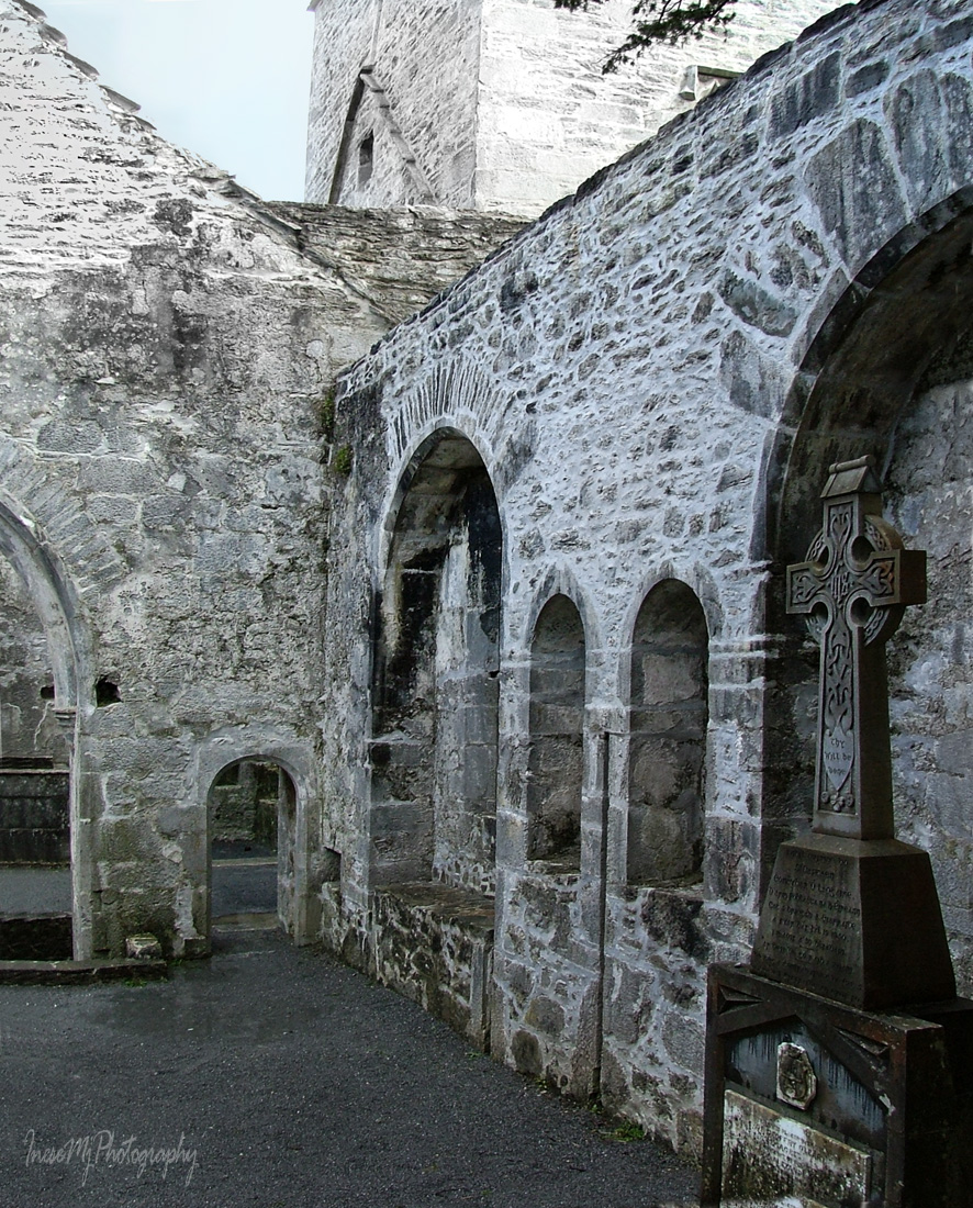
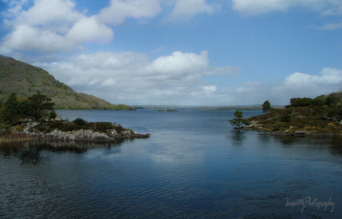
Back in Killarney we have just enough time to visit the Ross Castle.

It is not clear who built the tower house and when, but more likely it was built by some of the O’Donoghue chieftains in the late 15th century.

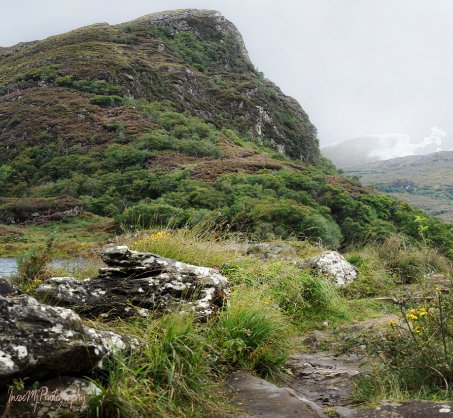
The trails around the Ross island and copper mines are a place of magic.

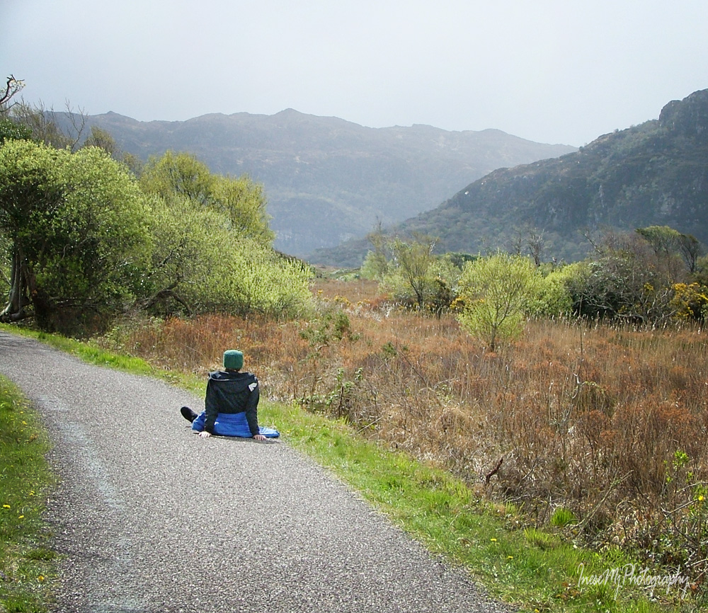
Once I got lost after leaving the main path. I could see the trail, but was not able to cross the mossy area – first, I didn’t want to damage the centuries-old biotope, second, I sure didn’t look forward to stepping in a mucky water hole on the way. So, I just had to walk all the way back.

Our epic 16 hours long trip is over! This is my hotel – they repaint it now and again, so I made the picture in b&w to avoid confusion. I like it for the perfect location and price.

I am glad to be back home before Christmas.

 Have a wonderful week!

A day trip to Kerry: we have a guest!

Happy Thanksgiving wishes for everyone! 

Today we have a guest, but before he arrives we are going to drive to Muckross, visit Killarney National Park and finally take that jaunting car ride you are dreaming about 😉

From the Molls Gap we take a road to Killarney. We are going to return by the same road later, but it won’t be boring since the road is beautiful and there are places to see. The road sign says ‘100 km/h’ but it is not for us 🙂 Please never drive over 80. There are cyclists, hikers, drivers who are trying to park, and you don’t want to create a tragedy.

As we drive we pass a number of spots suitable for parking of one or two cars, and with any luck we will park for a minute and walk to the lake.

Killarney NP

Killarney NP

Finally we see a huge blue sign Killarney National Park , turn in the gateway and drive to the Muckross House. You can spend your ‘time allowance’ (3 hours altogether) in the House and the Gardens and hire a jarvey to take you to the Muckross Abbey and back.

Muckross Abbey

Muckross Abbey

Killarney jarveys have been around for over 200 years.

jaunting car


The jaunting cars had been banned from the National Park, and were allowed back again.

jaunting car

I won’t share any pictures of the house. The Muckross House website has enough information, and there is also Google.

You will have to book a tour to see the interior, but if something goes wrong and there is no tour, just take a walk along the lake and visit the National Park. Here you can find two walks to choose from, and here another few.

My personal favorite is the 8 miles long Muckross Lake Loop, that also starts from the Muckross House. You will love these miles 🙂 Pictures below were taken from this trail.

Killarney NP

Killarney NP

Killarney NP

Killarney NP

Bridge between Lough Leane and Muckross Lake.

Killarney NP

Meeting of the Waters – Lough Leane, with Muckross Lake behind me.

Killarney NP

On the way to the Dinis cottage ( you will love their scones). Poor hiker gave up, apparently.

Killarney NP

After we are done with hiking, my plan is to go back to the Molls Gap to pick up our guest. On the way, we will visit one of the most photographed vistas in Ireland – Ladies View.

This is the classic view.

ladies' view

You can drive just a little bit further to enjoy the same view and a bonus walk.

ladies view

Killarney NP

Killarney NP

Killarney NP

Before I introduce our guest, I want to share a funny video. Foil Arms and Hog here give you an idea about riding/driving in Kerry 😉


Listening to these confusing directions, I started to worry about our guest getting around Kerry, so I sent him a few photographs in advance 🙂

And – here he is! Meet Kevin Hotter from KevinHotter.com!

Kevin, please tell us about yourself and the reason you are here with us on this trip.

Hi Everyone! Kevin Hotter, here. It’s a pleasure to meet you all. 

I’m an American lawyer, comedian, writer and photographer who lives in sunny Los Angeles. As if that stuff doesn’t keep me busy enough, I’m also a husband and a dad. And those two roles are my favorite! (Gotta make sure my wife reads that part.) 

Thank you so much to Inese for sending me photos of the beautiful areas of Ireland from which my maternal grandparents hail. 

My mother’s parents arrived in America separately. Having never met back in the old country, their paths first crossed while living in Chicago (which, at the time, was a very popular destination for Irish immigrants.) After getting married, they moved to New York City. And that’s where my mom was born and raised. 

How Irish do you feel?

I definitely inherited the famous Irish wit. And in my stand-up comedy routine, I definitely tell a few jokes about my Irish-Catholic upbringing and my very fair (and easily sunburned) Irish skin. Living in California, I finally have a tan! Well, kinda. Haha 

My humor is meant to bring people together and to poke fun at this thing called life. As for my Irish jokes, it’s all in good fun – because I’m extremely proud of my Irish roots. 

Well, enough of my blabbing! Thanks for reading about little ol’ me.  And please swing by my blog to say hi! 

Thank you for joining us, Kevin! 

Please visit Kevin’s blog to enjoy his outstanding photography.


We resume our trip and take off to Kenmare and The Ring of Beara before starting the homestretch of our day-long journey – The Ring of Kerry. It is a lunch time, and we will get something to eat on the way. Good news, folks! You can park for free in Kenmare! You can also stop for lunch at Molly Gallivan’s. The 90 km journey will take some 2.5 hours. Watch for the parking opportunities so that you can take a photograph, but don’t be a nuisance and danger to the other road users. Our loop route:  Kenmare – Glengarriff – Adrigole – Healy Pass – Glanmore Lake – Kenmare. Not the whole ring, but enough to remember that the Ring of Beara is the most scenic route in Ireland.

Leaving Molls Gap and heading to Kenmare.

Pretty Kenmare town, full of colors.

A nice place to have a lunch (opens @12pm)

Molly Gallivan’s Cottage, and a 12 ft Druid pointing his camera at the Barra-Bui Peak.

Druid’s view 🙂

Scenic road to Glengarriff is also a road from Co Kerry to Co Cork. Beara peninsula is the only peninsula in Ireland that is located in two counties.

Climbing the Healy Pass from Adrigole, south to north. In the middle of the tourist season, I would drive north to south: if you never have a chance to stop, the beautiful view is still in front of you all the way down. It is only my suggestion though. You can also take great pictures from the summit.

As we crossed over the Healy Pass, Glanmore Lake view is our reward.

We return to Kenmare sneaking through the beautiful vistas. See you again in two weeks to resume the Ring of Kerry trip. It will take another 5-6 hours to complete (including a stop for dinner in Waterville).

 Have a wonderful weekend!

A day trip to Kerry: The Gap of Dunloe

It is safe to say that every tourist visiting Ireland knows about Killarney and The Ring of Kerry, yet majority have no idea about how much you can see in a single day if you drive a rental. There are two types of tourists: the ones who can come again, and the ones who can’t. In the following 2-3 blog posts I will give a timeline and a few tips, and even spare 3 hours for a bonus deviation to the Ring of Beara to those who are planning a trip of a lifetime. You won’t see everything, but you will be able to say ‘have been there’ about many places. This day will start shortly after 6 AM – it is a summer day I am talking about 🙂 You will be able to have a proper meal in Waterville and return to your hotel after the sun goes down at about 10 PM. Sounds crazy, but doable. I added some extra time for the short walks and photography 🙂 Just bear with me.

Our Kerry trip will include The Gap of Dunloe, Killarney National Park, Kenmare, Glengarriff, Healy Pass, The Ring of Kerry, Killorglin and possibly the Ross Castle at the sunset 🙂 All in one day.


The Gap of Dunloe is unique. Every visit is unique. I was very surprised when I didn’t recognize the road we traveled in 2002, but that was early spring and the rain-swollen lakes and River Loe changed the landscape. This time the black rocks dominated the vistas.

The video below shows the same route, but starting from the Molls Gap. My plan is to start at Kate Kearney’s Cottage. Why? 1. Because it is the most spectacular end of the route, and if you don’t feel like driving after all, you can leave your car at the cottage, walk 1.5 hours and return. 2. Because it is the busiest end of the route and you want to be there as early as possible. The road is extremely narrow and can be quite busy ( you will see it in the pictures). Local people commute to work, tourists drive, walk, and take a jaunting car tour. It is quite a crowd. After 9-10 AM you are a nuisance to the other road users, and likewise they are a nuisance to you lessening your chances to stop for a picture. They say that after 6 PM the road is quiet again, but you might want to check the position of the sun.

This video was posted by Retro Ventures Ireland. I chose it because of the map they feature.


The route of 20 km will take you an hour, but if you find a spot to park ( away from the road) you can hike a little. Anyway, I am giving you three hours to enjoy the route and hike around. On some stage there is a left turn to the lake (tourist route). It is where the organised tourists take a boat across the Lakes. We won’t turn there unless you are already hungry and want to stop at Lord Brandon’s Cottage for a bowl of hot soup. We keep driving through the Black Valley until there is a road sign to Kenmare (left). This road will take us to R568, where you turn left again and drive to the Molls Gap. There we find a place to park and take a breath. We will resume our trip in two weeks 🙂

Driving tips: take it slowly, there are several 90-degree turns up and downhill; automatic transmission and a smaller car would be a bonus, but I have seen trucks and vans in this road too; don’t ever park in the passing places (pullouts), and if you stop there for just a photograph, watch the road and don’t cause problems to others; check the route in the Street View – there are several spots where you can actually park your car if the ground is dry – I parked in such spot for 4 hours, didn’t bother anyone; follow the common rules about driving up and down the hill, and don’t forget that if two vehicles meet on a narrow road, the person who advances first will be responsible for a damage to the other vehicle if something goes wrong.

Now I am sharing my pictures of the Gap of Dunloe 🙂

This time I parked at the trail head of the Circular Trail, less than a mile from the Kate Kearney’s. There was only one car at that time, but when I returned at about 13.00, there were 8 cars parked on both sides of the road.

Beautiful sunny morning disappeared as I was getting closer to the Gap.

The rest of the world still enjoyed good weather.

Approaching the Wishing Bridge ( make a wish while crossing the bridge; it will come true )

Look back – view of the Coosaun Lough from the Wishing Bridge. Very little water this year – I cannot even spot the River Loe connecting all five lakes.

Drizzle won’t stop us.

Jaunting cars joined the hikers shortly after 9 AM.

A few words about the jaunting cars. There are hundreds of them around Killarney, and it is a fun (but not necessarily comfortable) ride. It can be costly in summer, and I wouldn’t book it online. Local coachmen (jarveys) have been taking tourists around Killarney since Victorian times, and the companies offer a number of standard 1-2 hour routes. If you are able to drive ( or walk ) through The Gap of Dunloe, I would advise you to do so and leave the jaunting car ride for later, at the National Park (next blog post). If you still fancy to take a ride, approach any jarvey at Kate Kearney’s.

Unemployed horse.

I love this atmospheric place.

My first bird today, and it is a Robin 🙂

Rainbow sheep is a special breed 😉 You don’t have to paint sheep all over to brand them. The only purpose of this art is to attract tourists.

I was busy admiring birds and sheep; meanwhile the car heading to the Gap just 15 minutes ago was on its way back.

I won’t be as fast…

I stop to watch the young Pipit’s antics and to take a breath.

A look back. I feel like it has been a mile, but you can find these two rocks in my previous picture…

My favorite view.

I didn’t stop at the Iron Bridge but kept climbing. The road was getting busier. Jaunting cars are quite jumpy, and I hope the lady traveling with her grandchildren took some decent pictures.

Another bridge. A Broadband company van soon joined the queue, and two cars approached the bridge from the other side. A traffic jam, Dunloe style.

By the time I came closer to the bridge, the traffic had cleared. The weather improved and I took a few pictures of two bridges and a tiny ‘waterfall’ – a proof that River Loe hadn’t dried out after all.

This was my turning point. I ate my snack, watched birds in the trees and made a note to myself that I would leave my car here on my next trip.

Walking back was as fun.

At the Iron bridge the traffic was so busy that I sat on the rock and waited for them to clear off. On the other side of the bridge there is the place where two tourists were killed back in April. Pony got scared and bolted, and the couple were catapulted from the carriage into the rocky ravine.

The traffic started to thin out and I finally crossed the bridge. I wouldn’t drive at this time of the day – neither would I take a pony ride. Well, only to save my life, may be.

One last glance at my favorite view…

… and one more traffic jam.

This jarvey doesn’t waste his time while waiting in the passing place, and continues his lecture. Many jarveys are quite knowledgeable.

Winding road along the Augher Lake.

The rock is waiting…

And here are the rainbow sheep again.

It is not easy to focus if you have to give way to the traffic coming from both sides.

Another snap.

I discovered that this gnarled tree is a home to a Goldcrest family.

Enjoyed watching the cutest baby Goldcrest, and took a hundred pictures of him.

It wasn’t as easy to photograph his daddy who was fast like quicksilver and hid himself behind the leaves and branches. I am sure it is a daddy because he has a bright orange stripe on his yellow cap. After taking this picture I packed my camera and walked to my car as I had many other places to visit.

Thank you for walking through the Gap of Dunloe with me. See you in two weeks.

 Have a wonderful weekend!