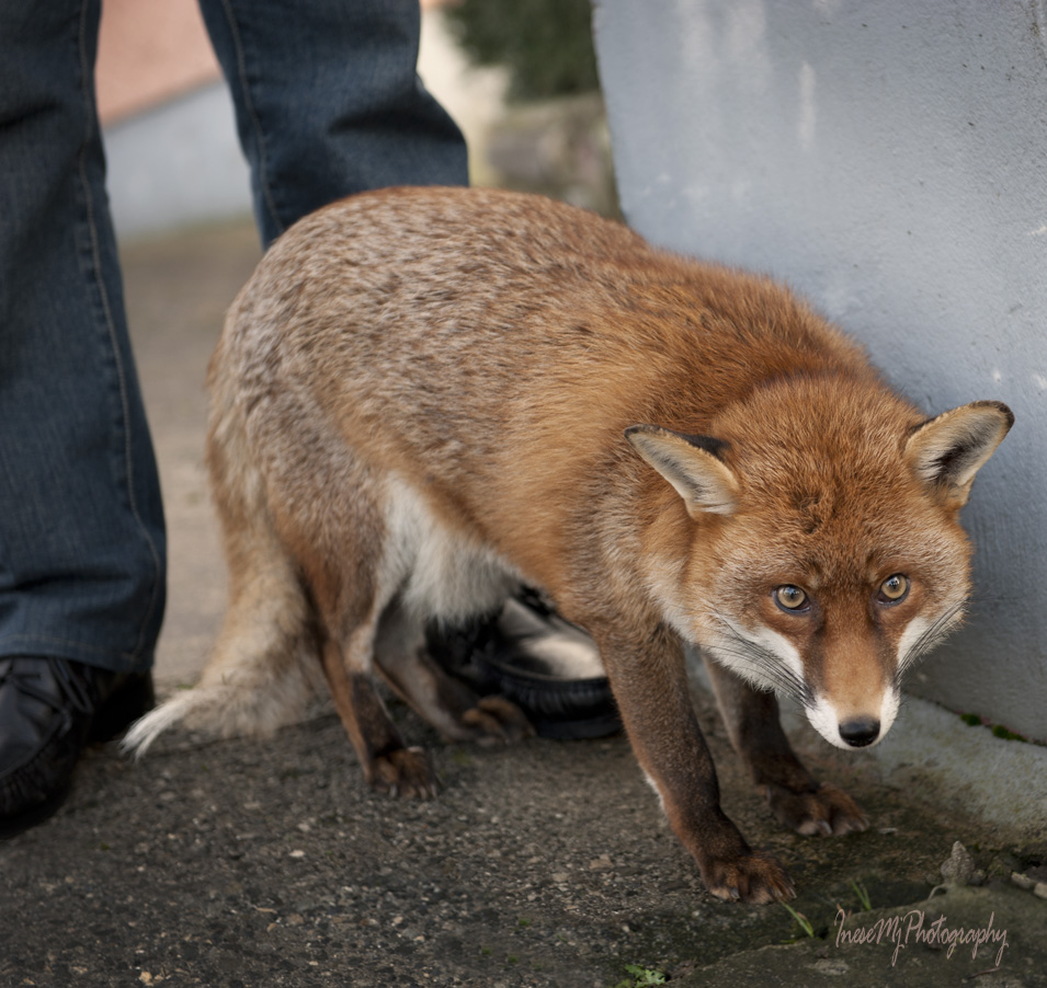
On my way back from an assignment I turned off the main road and drove under the canopy of old trees to the house of my favorite people. I wrote about Pat Gibbons and his family in these blog posts : in 2015 and 2014 It has been a while since I last visited, and I didn’t call in advance. I saw that the door was half open, and parked at the side of the road. Another car slowly approached, and parked across from me. I didn’t plan to take any pictures and knocked on the door just to say hello, but Pat was about to take the foxes outside for a minute anyway, so I went to pick up my camera. Meanwhile, a family got out of the other car and asked me if it was the Fox Man’s house. The word spreads 🙂
Pat is always happy when someone shows up to see his foxes. ‘It is why they are here’ he says. He told the visitors about where the foxes come from and about Gráinne’s career as a movie star. She is as beautiful as always, just with more silver in her fur.
Minnie is soft and shy – nothing has changed here 🙂
It is the time for hugging.
Gráinne is tired.
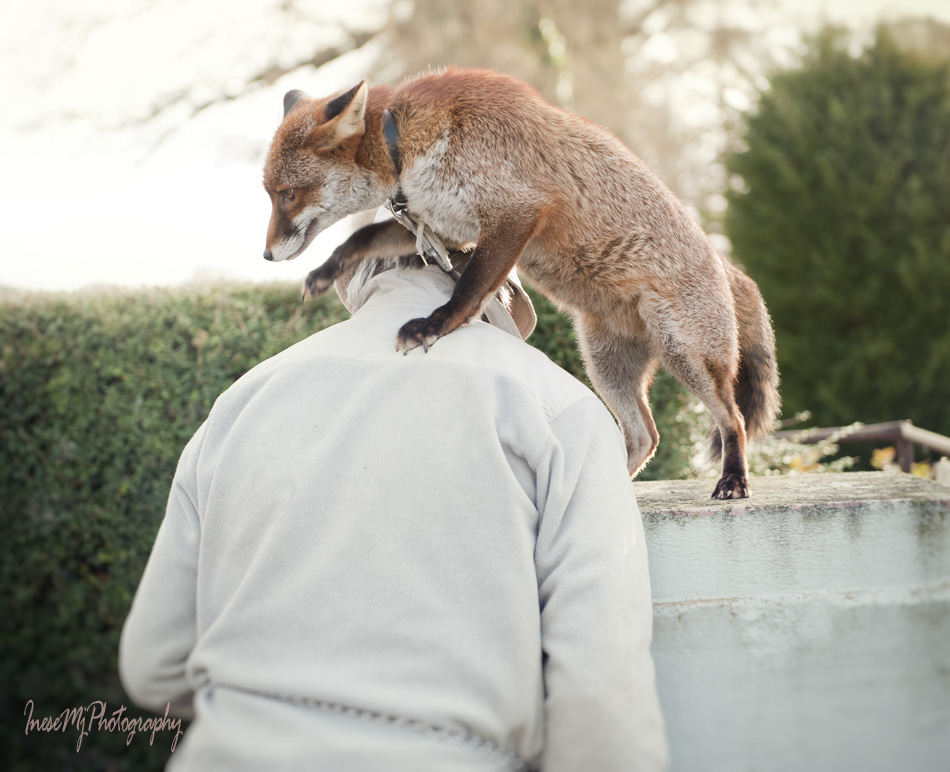
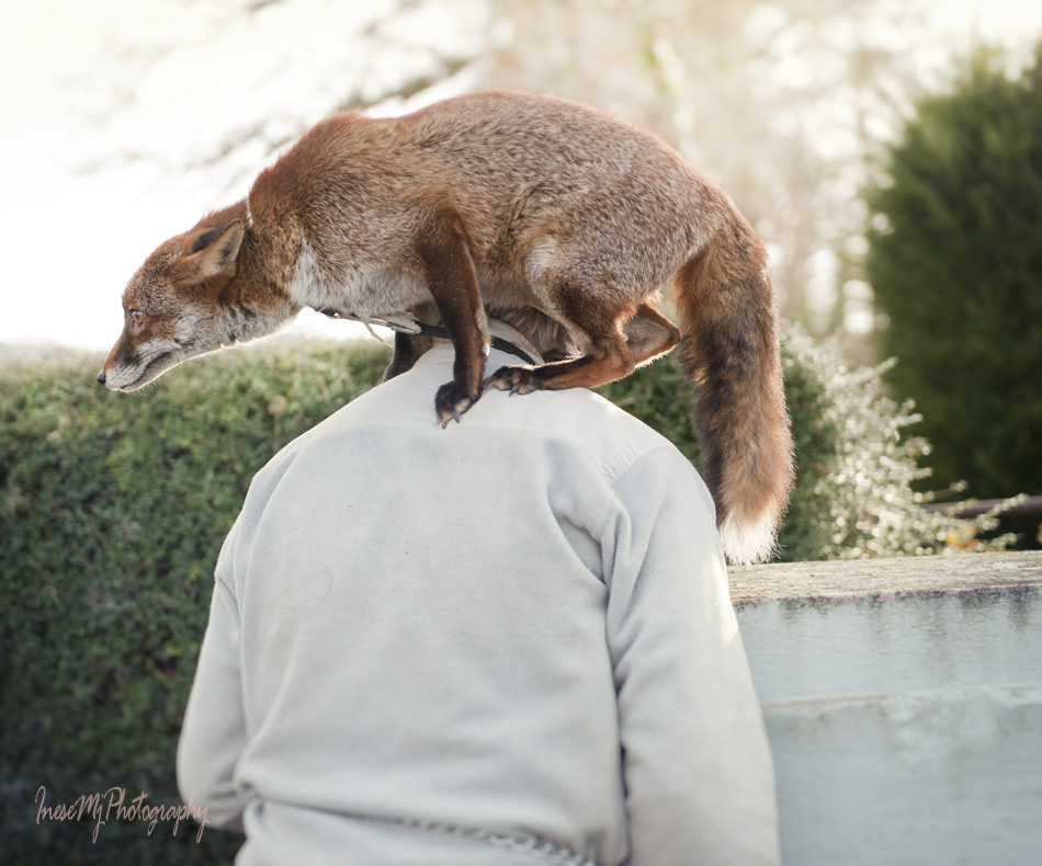
She does a bit of posing for pictures.
Pat is asking Gráinne to perform her famous trick.
We walk to the pen to visit with Henry. He is not in the mood to go outside this time.
In a couple of hours they all will go to Pat’s house and enjoy their evening together cuddling and watching the TV.
I know you all love this post and the foxes 🙂 Thank you for stopping by!
After a short break we resume our hill walking exercises.
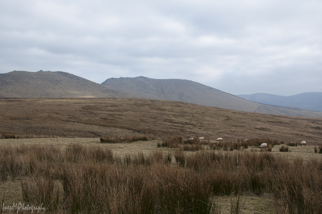
When you look at the picture, you see a sharp-peaked feature on the silhouette of the slope of the mountains in background. Remember it, I will tell you what it is in the end of this post. The mountains you see in the picture belong to the Knockanaffrin Ridge, and we are walking across the Comeragh Plateau.
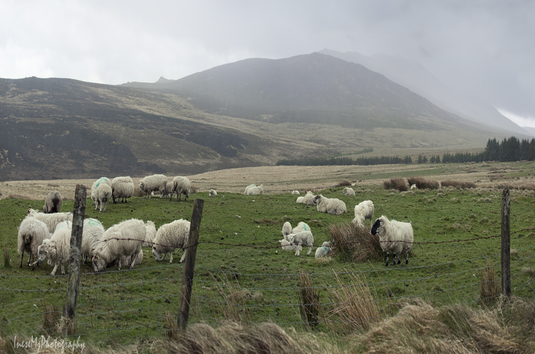
I feel sorry for the little lamb – the gusts of wind are throwing the hail at the car window, but he is standing there and staring at me.
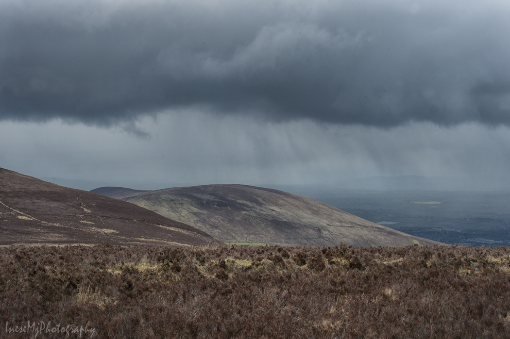
Another season, another storm. Heavy rain passed over Clonmel and the hills we visited in my previous post from the Comeraghs.
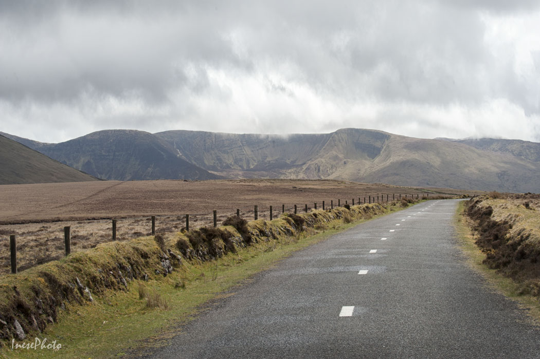
In my first Comeragh blog post you saw the other side of these distant Laghtnafrankee mountains – Glenary Valley. To get a closer look at the mountains, we will turn to the other road. There are two roads, both of them finally coming together and taking you across the Comeragh Plateau from Clonmel to Ballymacarbry. Right now we are walking along the Harney’s Cross Road, the upper one.
This is a closer view of Laghtnafrankee from the lower road. The real summit is right behind it. There is also Laghtnafrankee SW Top on the left side. On the other side of Laghtnafrankee there is a natural amphitheater – so called Punchbowl. If you enlarge the image by clicking on it, you will see a tiny lone hiker on the slope, right where the shadow of the cloud begins. He gives you sense of the scale. The Comeragh Plateau is nestled between the Lachtnafrankee and Knockanaffrin Ridge.
This is the view from the lower road with the Knockmealdown Mountains in background.
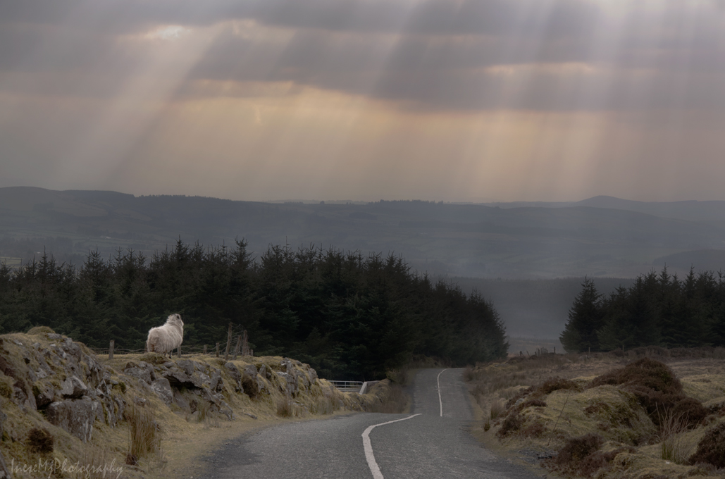
I took many photographs of these stunning crepuscular rays that winter afternoon.
Another season, and the mountains look different again. Shauneenabrega Mountain is wrapped in thick fog.
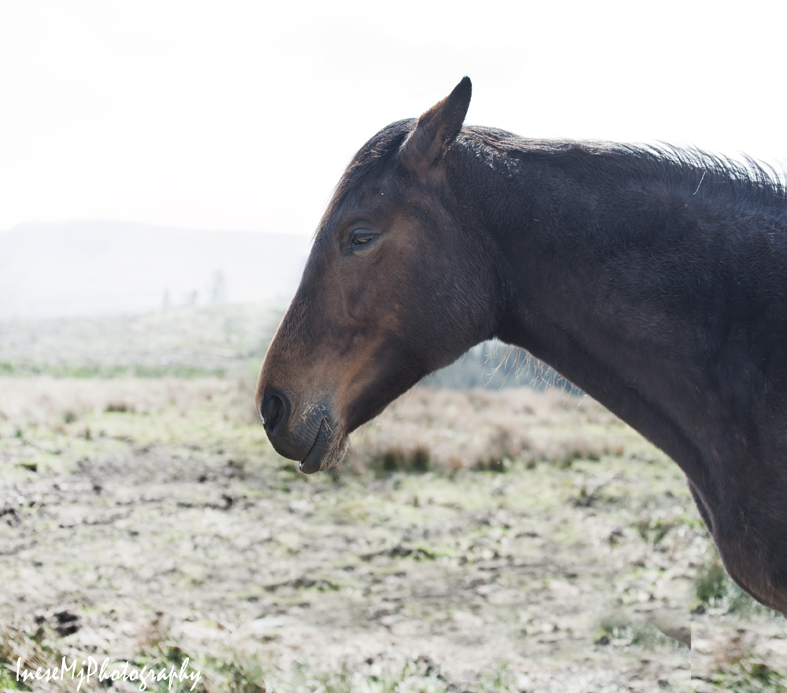
The horse ignores me. She hates snow. I think that this horse ‘works’ at the nearby turf cutting. I remember the bad experience I had visiting the Woodstock Oyster farm and abandon the idea of walking across the bog to the turf cutting site. May be another day.
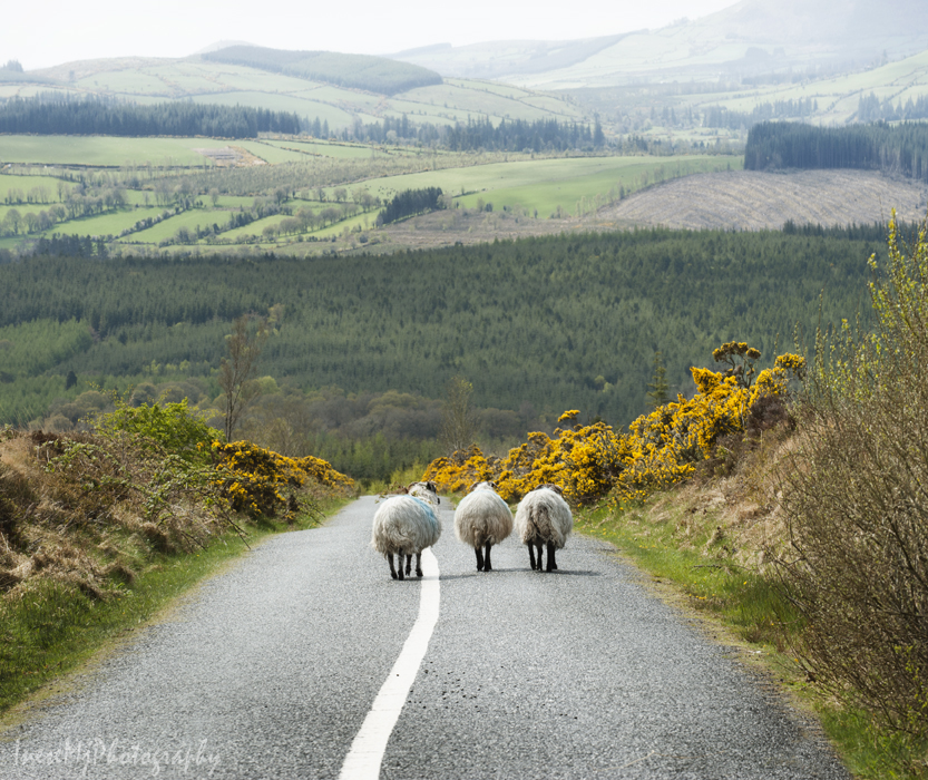
The same road in Spring with the Three Graces refusing to pose for me.
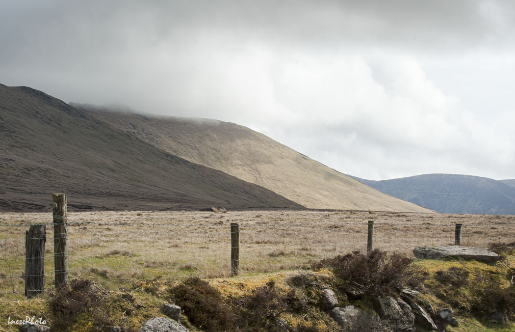
More of the Knockanaffrin Ridge in this picture. The summits of these mountains offer beautiful vistas with Lough Mohra Coum nestled beneath the steep slopes. You can walk from one mountain to another along the crest. Most of the summits have cairns.
I like the minimalist look of this picture 🙂
The top of the Long Hill ahead. We are returning to the main road between Clonmel and Rathgormack .
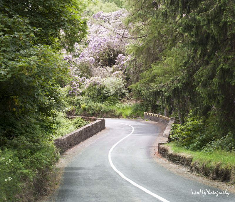
Early June is my favorite season in the Comeraghs when Rhododendrons bloom.
Do you remember the first picture and mysterious sharp-peaked thing on the slope? It was the summit of the beautiful Knockanaffrin.
You can walk from Knockanaffrin to Knocksheegowna along the crest. There is a trig pillar near the highest point on the top of Knocksheegowna. If you hike over The Gap ( the trail starts just a few meters from here), there is a beautiful Nire Valley on the other side – it is where we are going to walk in my next blog.
Today we will do a bit of hill walking as most of us have consumed those extra calories between the Christmas and New Year day 😉 Comeragh Mountains is a good place to start since you have already seen them from the top of beautiful Slievenamon. Here she is, my favorite mountain, as seen from the ascent to the Long Hill of the Comeraghs. First of all we will find the source of peculiar clouds that look so nice in the photographs, so let’s walk towards Slievenamon and have a closer look.
I always blamed Bulmers for the clouds – or Magners, as the product is called outside of Ireland. Famous Irish Cider brewery and the cloud maker, a timber company Medite, are situated in close proximity. Now the justice is restored thanks to the reader who pointed out my mistake.
Dramatic clouds enhance your photographs, but is this steam emission harmless? I don’t know.
The Comeraghs are formed by twelve mountains and various hills. They are located between Clonmel, Ballymacarbry, Dungarvan and Rathgormack. The highest point is at 792m ( 2,598 ft). In the photograph below you see the foothills of the Comeraghs from Clonmel side of the mountains. The upper part of the hills is wrapped in a tick cloud.
This picture was taken in March. The setting sun colored the tops of the bare trees and made them look like autumn foliage.
You are standing on the top of Scrouthea Hill – Cnoc a Chomortais. To get there you walked from Clonmel town all the way up, catching your breath and feeling lightheaded. Well, you can also drive most of the way. If it is an August Bank Holiday, another thousand people are walking up the hill beside you, partaking in the annual tradition of The Holy Year Cross Walk. The Holy Year Cross was erected in 1950. The original timber cross was carried by fifteen strong men.
I hope you already recognised the mountain in background 🙂
From here you will walk south. The picture gives impression of a rather flat surface. In fact, the descent and the following ascent are quite steep. All the brown-colored area is infamous Comeragh bog. It is wet all the year round.
In summer, the bog turns purple with the blooming heather.
Before you continue uphill to the crest of the Long Hill, walk off the main path to visit the abandoned farmstead that used to be a home to the Ireland family.
The Ireland family farmstead is the most tranquil place I have ever visited. You will spend at least an hour around the farmstead reflecting and meditating, taking photographs and enjoying the beauty and serenity. Only a hiking club party might disturb your peace, but this seldom happens. A lone hiker will more likely wait until you leave, and come down later.
After walking through the bog you will appreciate the flat, firm and dry land and silky grass of this oasis. How sad it is that the family had to desert their home and fields as they had given up the struggle to work the land.
By the way, the Ireland children had to climb the hill to attend the school in Clonmel.
Leaving the oasis you continue uphill through the bog to the summit of the Long Hill ( just for a spectacular view), keep walking south until you reach Lachtnafrankee mountain, and then a steep ascent takes you to Glenary river valley.
Across the river, there are remains of Glenary village. This was a street with the houses on the riverside and the fields on the hillside.
The village mostly consisted of clochans – clusters of houses with a shared entrance and farmyard.
It is difficult to believe that the last inhabitant left the village in the 1960s. His house had thatched roof and red door. It only took a few decades for the Nature to consume the buildings so that some of them literally disappeared.
Glenary with Long Hill and Laghtnafrankee mountain in background.
The view from the hillside over the valley. Carey Castle I recently wrote about is in the woods behind the cottage.
To return to the Cross you climb a steep and muddy track – you will need your Wellies for that. A herd of cattle walk in the deep mud twice a day, which doesn’t improve the surface of the track. This is the view from the top. The Cross is on your left, but it is not visible from here.
These photographs are 8-10 years old. I have no time to return to the Glenary Valley, but I visit Carey Castle every year.
It was a long walk but we only covered a tiny part of the mountains.
I am taking a break, and hope you will be in a good form to continue hiking in the Comeraghs in two weeks from now. Meanwhile, I will repost some of my old stuff from 2014.