Month: September 2015

Traveling American Southwest… Part II

res2008 trip 1 344

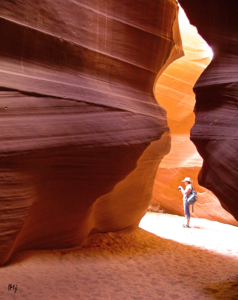
At the exit of the Antelope Canyon ( see Part I), we saw this little chick on the ground and heard his mama chirp somewhere close. I quickly took a picture and off we went, in the back of a 4-wheel drive comfortable truck.

In the evening, driving around, we stopped at the marina parking lot and took some pictures of the endless sky, Colorado River, and Navajo Generating Station –  the third largest emitter of carbon dioxide in the USA.

colorado river

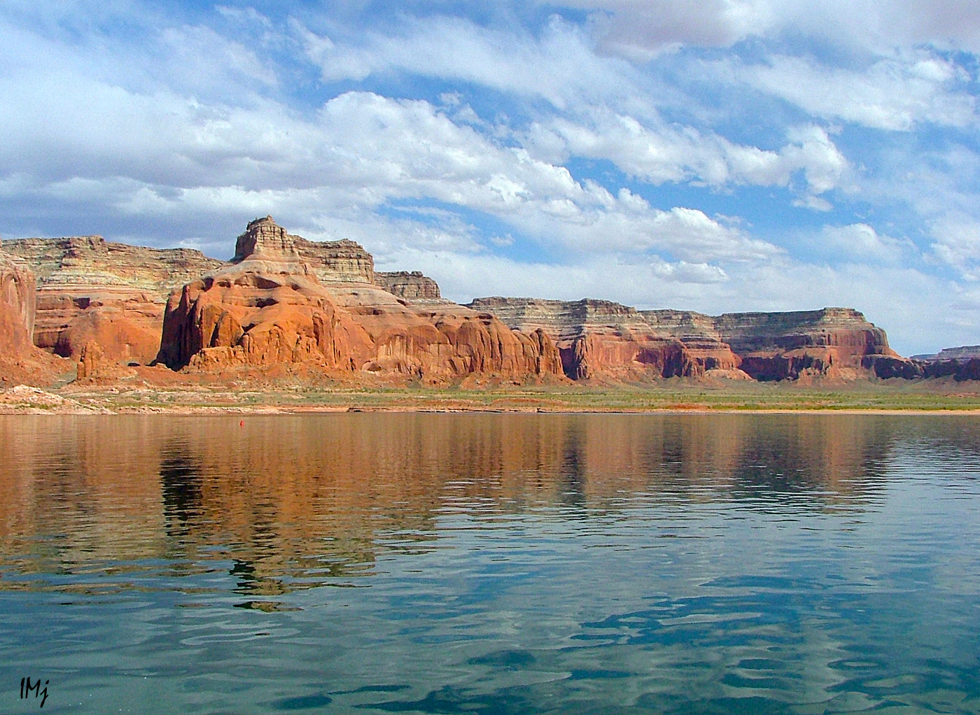
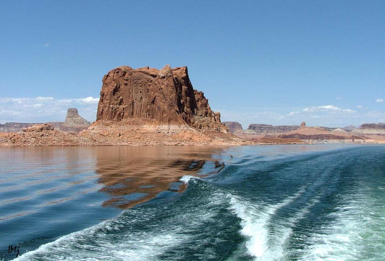
The next day we drove, all  excited, down to Lake Powell to take a boat tour to the Rainbow Bridge.  A two hours boat ride or a two day hiking? You have to choose if you want to see many places in just a few days. The tour took about five hours, from which four hours on the boat with the most breathtaking scenery all around, and a fresh breeze.

res2008may 004nohdrres

lake powell

lake powell

This is a furnace ( only about a mile long though) we had to hike through to get to the famous natural  bridge. In the evening I was all red like a lobster, and it was only May!

hike

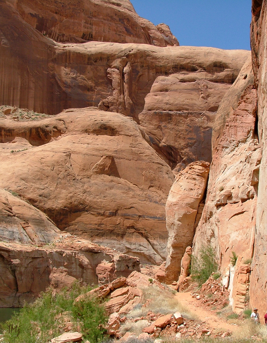
We turned around the corner, and there it stood.

Rainbow bridge

lake powell

My daughter said that she wanted to sing for us, and she did, and it was really moving.

Judy Garland, “Over the Rainbow

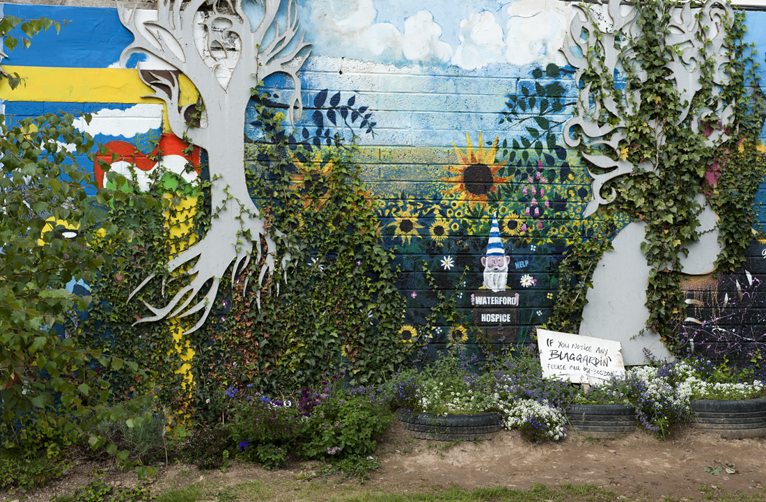
The next day was Sunday. I saw that there was a church across from our hotel, and I decided to go and mingle with the locals.

I entered the room  and quietly sat in the  back row. When I looked around I realised that all the congregation except me and another couple were either Native Americans or Mexicans. Presiding was a solemnly looking Native American man with long hair, who spoke with majesty and authority. I was mesmerized.

After the service I was about to sneak away, but two young men who sat next to me started conversation and marveled at the fact that I came all the way from Europe. I really enjoyed our conversation and marveled at the fact that I was chatting with 100% Native Americans 🙂 After 40 years, since…

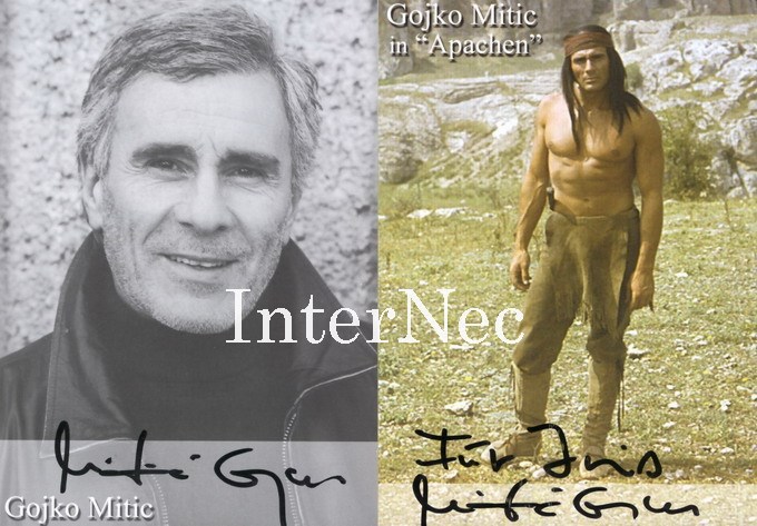
In the 1960s, DEFA film production studio based in Berlin, Eastern Germany  produced the Western The Sons of the Great Mother Bear, directed by Josef Mach and starring Gojko Mitić. Many other films followed. Basically, the films portrayed the good Native Americans and the bad white Americans. What else would you expect from the Cold War era movies 🙂

The DEFA Film Library at the University of Massachusetts Amherst is the only archive and research center outside of Germany devoted to the preserving and promoting DEFA movies. In October 2005 the Museum of Modern Art in New York City hosted a two-week DEFA festival, and several titles are now commercially available on DVD.

And for those who wonder – no, this is not American Southwest 🙂 In fact, it is not America at all. The movies were filmed somewhere in Southern Europe and even Mongolia.

To make a long story short – In  this photograph you see Gojko Mitić.

YoungMitic

I was 10-12 years old at that time. The crush wasn’t on him! I still have no idea if he was ever married or something. The crush was rather on his characters 🙂

I and alike, were the most devoted fans he has ever had. We recorded the soundtracks from TV shows, we quoted his characters, we wrote screenplays, made tomahawks and bows, and all sort of jewelry. We went to the library and researched all the books on American history and anthropology that were available. We have read all the books on which his movies were based! He influenced a whole generation, and somehow we knew that the white Americans were not as bad as we were told, because some of them were good friends of Chingachgook, Tokei-Itho, and Ulzana.

I wish all celebrities used their influence upon the young generation as he did.

In this photograph, he is 75 🙂 Yep.

cache_32314954

The following morning we left Page AZ and traveled North.  After visiting Monument Valley we took Utah State Route 261, passed stunning rock formations  – Mexican Hats, and crossed the Valley of Gods. I was clueless  about specifics of US 261… I just wondered, where are we going to drive if there stands a gigantic mesa all the way along the valley… When we approached the mesa, I got it. I asked if I can leave the car and walk. The answer was “no”.  Moki Dugway. I didn’t know we were destined to meet…

Holding my camera tight, I stretched my arm out of the window, closed my eyes and up we went. I cannot tell how many switchbacks are there. Five? Six? There are no protective walls or anything, and we were lucky that no one was traveling down the mesa in their campervan.

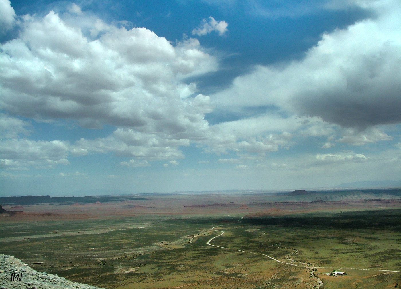
Most of my pictures look like this one.

moki

Valley of Gods from Moki Dugway.

moki dugway

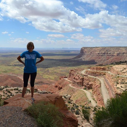
This is my daughter’s photograph taken on the top of Cedar Mesa  this year when they traveled the Southwest again. You can see some of the switchbacks.

moki dugway

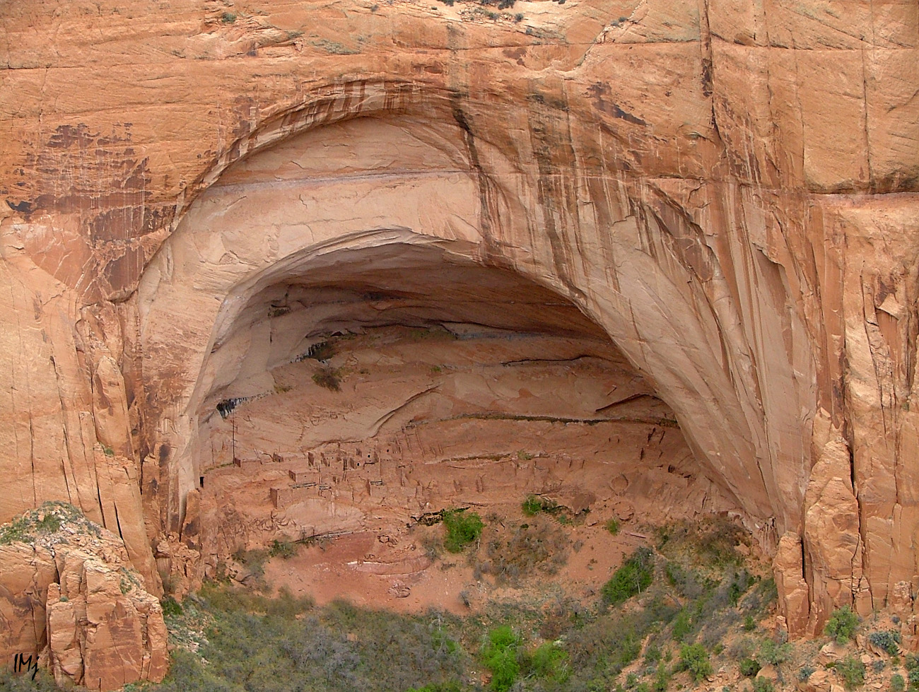
Our next stop, Navajo National Monument. In the photograph below, there is a whole city in the rock, Betatakin cliff dwelling, as seen across the canyon. Anasazi lived there in the 13th century and vanished  overnight without a trace.

dvellings

A dinosaur footprint.

dino track

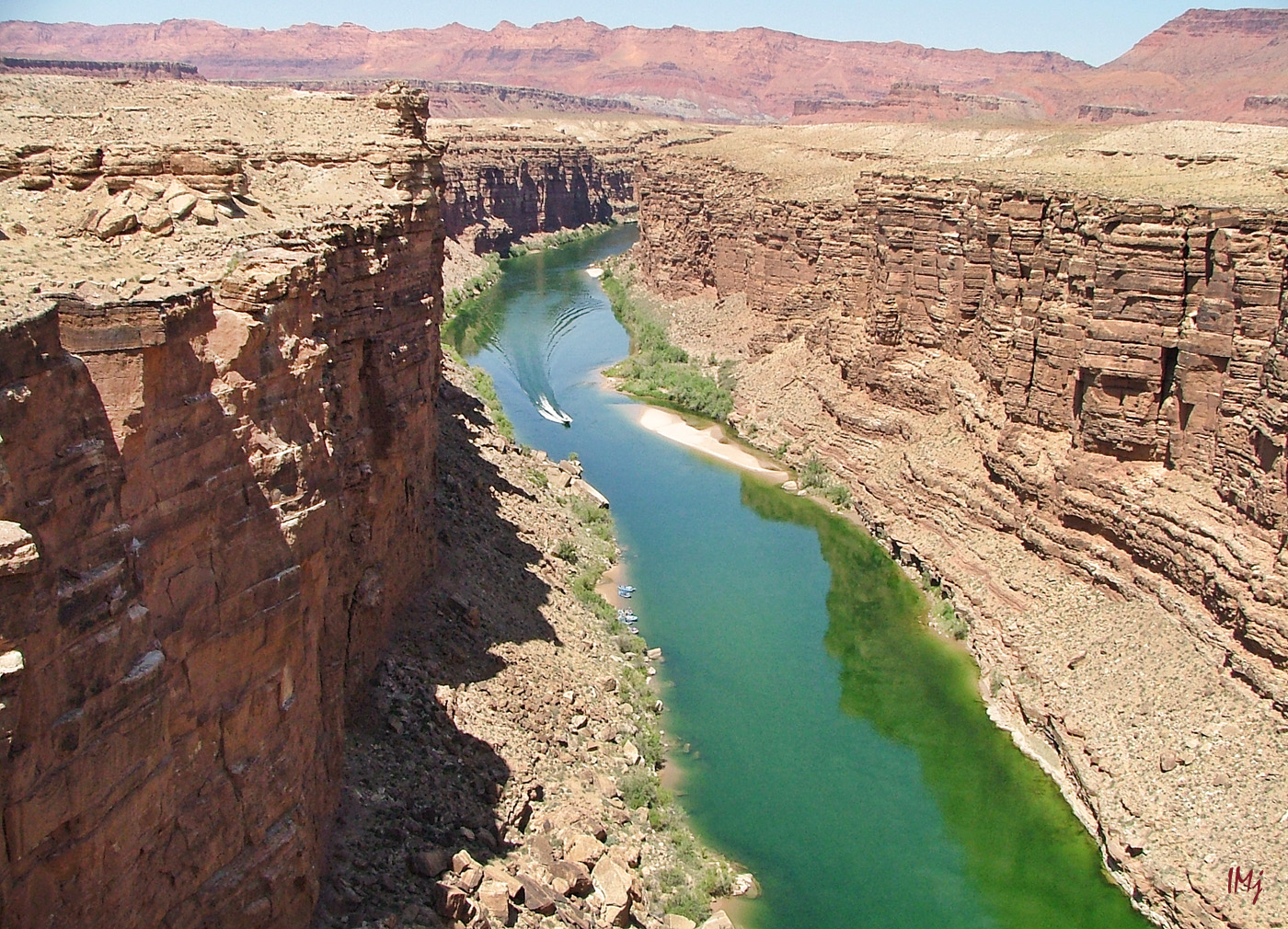
We traveled through the beautiful desert, and finally crossed the Glen Canyon again.

glencanyon

This is actually a picture of the same area, but taken from the top of the canyon wall. You can see the bridge across Colorado River near the confluence of Dirty Devil River.

glencanyon

Unlike the DEFA movies, this American Southwest is real 🙂

One more video,  and Ennio Morricone music for you.

Thank you for your company!

IneseMjPhotographyHave a great weekend!

Traveling American Southwest, Part I

three gossips

I have this image of Three Gossips taken in color at the sunset, but I added  gradient and changed color balance to make it look like a distant memory, because I will share some almost forgotten, and for most of you, unknown memories… in my next blog, Part II 🙂 But first, let’s go back to the story about our Southwest travels.

We have made two trips to Southern Utah and Northern Arizona, in 2007 and 2008. Our first trip included:  Arches National Park, Four Corners, Little Colorado River Gorge, Marble Canyon, Grand Canyon, St George, Cove Fort – a round trip  we had made in five days.

There is no photograph that could adequately depict the stunning beauty of Arches National Park. You come there in awe, and you leave in awe. If you are short of time and cannot stay longer than one day,  I would suggest something like that:

Morning – Devil’s Garden Trail and Landscape Arch ( 2 hours) and probably another 2-3 hours if you want to walk to the end of the trail ( we didn’t);  Double Arch ( 30 min); The  Windows ( 1 hour). It is just how long it takes to walk. You will need more time – driving, taking photographs, sitting and admiring the scenery.

Afternoon – Delicate Arch ( at least 3 hours; parking is limited!); Balanced Rock before the sun goes down ( 30 min). Check the map to calculate how long it takes to drive from place to place.

Check out the links to the long and short trails, but regardless of the distance you have to take a lot of water with you.

There are 2000 arches in Arches Nation Park. Well, perhaps 1999, since the Wall Arch collapsed in August 2008.

The best photographs of Delicate Arch come out in the afternoon. We went there first thing in the morning. It made sense because we had no idea how long it takes to hike, and we really wanted to stay there a little longer. Photography wasn’t our priority.

In the first photograph, Delicate Arch is just around the corner. The weather is changing to overcast, and the arch looks differently every half and hour. Sitting there and staring at the arch was one of my favorite activities in the Park. If you have been there you know what I am talking about.

arches

May 24-25 2007 145res

arches

This is the Landscape Arch, or what is left of it after the first slab of sandstone fell off in 1991. Still, it is the longest natural arch in the world with the span of 290 feet.

Arches

It is the Devil’s Garden trail, the most spectacular of all the trails in the park. The weather was changing, and by the time we reached the Landscape Arch, it was raining and we turned back.

Arches

These formations are called “fins”. I mentioned them in my previous blog.

Arches

The rain stopped and we actually visited more arches than expected. We took beautiful photographs of the Balanced Rock half an hour before the sunset, and the Three Gossips a minute before the sun went down.

This is the Window Arch. For the scale, see a tiny human sitting in the left corner.

arches

The following day we started our unhurried trip to the Grand Canyon, a ” hole in Arizona”. It is hard to put the Grand Canyon in words and pictures, and yes, “not all holes are created equal” 🙂 I was standing there speechless and almost breathless.

South Rim, Colorado River. Here we spent a day, hiking around and down in the canyon.

Grand Canyon

North Rim, the following day. There, we took a short  but breathtaking  Bright Angel Point trail.

GC

We walk along the narrow ‘peninsula’, surrounded with the stone ‘waves’. At the end of the trail, The Bright Angel Point, most of people just stand and stare across the vast expanse. It is difficult to believe that this  is all real. I think you will love reading this very informative and very poetic article about the area down there.

angel fault

Reading displayed information I had to smile. What is the Bright Angel Fault?  As I learned, faults are fractures in the Earth crust that occur under the pressure – compression, extension or side-by-side movement. The Bright Angel Fault is such a fracture that stretches almost straight across the Grand Canyon from the South to the North through the Bright Angel Canyon, which was formed through erosion along the fault.  Yes, the view that we see at the view point is not technically the Grand Canyon, but a side canyon,  the jagged border ridge of the Bright Angel Canyon!

The Bright Angel Fault is still active and has produced small earthquakes that visitors sometimes feel. The fault is visible as  a 186 foot displacement: you can see it in the image of the distant South Rim, where the left side of the horizon line is visibly higher than the right one (sorry it is heavily zoomed and taken with a 3 mp camera)

angel fault

I have read a lot about the side canyons, and I still have more questions than answers. I know that I will never hike the Grand Canyon and see everything by myself. I can only pray that the people who go there in the future are considerate and respectful to the Nature.

Little Colorado River Gorge, and Marble Canyon and Navajo Bridge are worth to mention not only because they are located on the way to Grand Canyon National Park and to stop there seems like a natural thing to do. These places are beautiful.  Cross both  – New and Historical Navajo bridges, and enjoy the emerald color of Colorado river if you travel early in summer. Little Colorado river is a bright  blue color, but later when the rains start, they both become chocolate milk  brown, and as the saying goes ‘ too thick to drink, too thin to plow’. Marble Canyon and  the Grand Canyon join where the Little Colorado River enters the Colorado River.

In the image below, a view from the Old Navajo bridge.

colorado river

On the way back, we had a stop in St. George, UT,  and visited their Pioneer Park.  We climbed up the Dixie Rock for the downtown panorama, and I can tell you that the place is certainly worth to stop by.

Our last stop was the Cove Fort, with their curious exposition of the 19th century artifacts, workshops and the Big Barn. Lots of history, with no admission fee ( the place belongs to the LDS Church).  We even learned how to play the long forgotten game! 🙂

cove fort

There is a wonderful book  – Travelers’ Tales, American Southwest: Arizona, New Mexico, Nevada, and Utah… A great read when you feel nostalgic.

The other trip was also a five days long trip : Coral Pink Sand Dunes, Lake Powell and Rainbow Bridge, Horseshoe Bend, Upper Antelope Canyon, Monument Valley, Mexican Hat, Utah State Route 261 and Moki Dugway, Natural Bridges National Monument,  Utah State Route 95 across the end of Glen Canyon, and a long drive through the breathtaking canyon country up to Salt Lake Valley.

As I said, we travel with no hurry. We stop to admire buttes and mesas; we  even climb them sometimes. We buy Native American jewelry made from  seeds,  beads and semiprecious stones; we watch the wildlife and marvel at the flowers bravely standing out against the barren rocks. One cannot plan discoveries and surprises.

desert

desert

On our way to Page, AZ we turned into the side road to check out a  unique place, a part of Zion National Park – Pink Sand Dunes.

Pink sand Dunes

It was fun to run down the dunes, and it is where I lost my wide angle lens…

We stayed in Page three nights exploring the area. Horseshoe Bend was one of the places on our list. I failed to take a good picture, but my daughter had a good fun taking pictures of me wriggling on my belly towards the rim with my camera holding hand outstretched, and with the mortified face. Due to the embarrassing nature, these pictures may not be published.

horseshoe

We went there again after dark. The full moon lit up the waters of Colorado River; wildlife enjoyed the coolness of the night, and we enjoyed watching the cottontails happily run around. I didn’t get any braver, and this sorry picture is the best  I have got.

Horseshoe bend

Another place on our list was  Antelope Slot Canyon. Probably many of you have heard about the tragedy that happened there in August 1997. We went to the safer and easier of the slots, the Upper Antelope Canyon ( the Upper and the Lower slots are a few miles apart) . All the land around Page, including Antelope Canyon,  belongs to the Navajo Nation. It is a family business, and we got a handsome young man for a guide, a University student who was on holidays at that time, and not only gave us photography tips, but also played the flute for us.

Antelope Canyon is one of the most mesmerizing places on Earth, where the light is everything. The corkscrew walls polished by flash floods change their color every second as the light bounces between the twisted columns. In the image below – Slot entrance.

slot canyon

Images taken inside the canyon, available light.

Antelope Canyon

Antelope Canyon

In my next blog, I will cover the rest of our Lake Powell trip, and reveal my first (and last) celebrity crush from the 1960s 🙂

IneseMjPhotographyHave a wonderful weekend!

Happy and Grateful

happy and grateful

After my trip to the Bryce Canyon I suddenly realized that it might be my last visit to the Southern Utah and Northern Arizona area, and there won’t be any new photographs to share, so I just wrote a blog and used my old pictures taken with a modest camera 7-8 years ago, before Nikon D 700 was released 🙂

But before I proceed with sharing my travel experiences, I want to tell a few words about another kind of travels.

Thousands are fleeing Islamic state and illegally cross the borders throughout Europe.  Wealthy Gulf countries, their Muslim brethren, refuse to take them; just some of the wealthy are willing to provide monetary help here and there.

Most of European nations ( and I don’t mean the Governments but people) have made clear they don’t want to see any newcomers in their countries, crisis or not. The poorer is the country, the louder the protests. Western Europe has not exactly thrown wide open its doors to the migrants too. Crisis turns into catastrophe.

I understand local residents who are watching with horror the Youtube videos of the migrants pressing forward, fighting with police, stealing unattended personal belongings when passing through the villages.  I understand their feelings when they read that some, already settled refugees, refuse to do hard agricultural works that are offered to them.  Local residents are afraid for their security, their own job, their national identity. Oh I understand them all right, no doubts about that. But will their hate help? Will their hate change anything?

We are not the Governments, the Banks, the Billionaires.  Let the influential institutions do their job ( there is no overnight solution, so be patient ). But to give a desperate, frightened, hungry, vulnerable,  language-less, right-less individual something more than hate – can we do it? I know that many griefs are self-inflicted. But please feed the hungry before questioning the causes of his hunger.

Eastern European residents – I know you have very little, but don’t you have almost half of your population scattered around the world and given a chance for a better life, even that you are not exactly welcome.  So, even if you don’t welcome refugees – don’t hate them! No country will prosper if her people hate others.

Don’t blame these poor souls for wanting to live in a different place than their own sorry country. Be grateful for your own good fortune, even if it is a very small good fortune. Live up to your religious beliefs, and if it doesn’t work out, stop waving the religious flag whatsoever – you cannot be born a Christian – you can only become a Christian, and it is not my job to remind you what it means.

The world is changing, the Governments have to deal with different problems than 50 years ago. I hope they do something about the refugee disaster before the winter falls. Europe is hardly a long-term solution. These people have to be settled somewhere – I hope they will, in their own land, in a safe, just place, with the help of the rest of the world. Help, not hate. As to those who are going to remain in Europe –  I hope they learn their lessons, and stay happy and grateful.

If people only knew how much they can achieve by just being grateful.

This post is dedicated to 09.11.01.

IneseMjPhotography This is my post # 100 🙂

Have a wonderful weekend ye all!

Waterford Walls

murals 199res

Waterford Walls is a visual Street Art project in Waterford City, Ireland. Irish and International street artists and talented school students transformed old spaces into extended art gallery. The first image is the work of Joe Caslin, a street artist and art teacher from Roscommon who is known for his project “Our Nation’s Sons” – large scale portraits of young men from disadvantaged social backgrounds.

In the image below, a man stopped to touch the surface of the portrait. I will tell you why.  Joe Caslin paintings are done on biodegradable paper,  and will come down within a few weeks.  We are lucky with the weather, and I hope the paintings will last another month.

murals

Another work of the same artist in Olaf Street. It is sad they won’t stay here too long.

murals

murals

I went around the city center to look for the other murals. First of all, I visited one of my favorite places in O’Connell Street and was pleased to find an interesting work.

murals

murals

After that I walked to Stephen Street. This is unused De La Salle Hall built in 1915. I love the new look of it’s facade. As it often happens in life, the facade is the only attractive part…

murals

murals

More murals in Stephen Street.

murals

murals

murals

murals

I like this mural  because the girl is holding a camera in her hands.

murals

It is where the rain started, and I rushed under the roof of a garage. From there I took a picture of a mural and a family with the matching umbrella.

murals

The rain didn’t last long and I walked to New Street to see the gardens and more murals.

murals

It was my last destination. There are about twenty murals, very colorful.

murals

This one is dedicated to Waterford Hospice.

murals

I stood there waiting for someone to come over and do something amazing, or at least something worth a picture, but there was no one in the gardens, so I just took a snap of the girl and her bees.

murals

Thank you for walking the streets with me. I know, it is not a once-in-a-lifetime trip, but think about the murals that won’t last longer that a couple of weeks. You have seen them!

This is sort of a similar exposition in 2008.

IneseMjPhotographyHave a wonderful weekend!